
Many planned freeways and expressways in the Capital District did not get built. The map above, created by Parsons, Brinckerhoff, Quade & Douglas for the New York State Department of Transportation, centers on Albany, showing multiple cancelled corridors around Albany. The Northway would have extended south parallel to the Thruway, running directly into I-787 at US 9W. The Mid-Crosstown Arterial would have extended south along the US 9 and US 9W corridor to I-787 and the Thruway. The South Mall Arterial would have extended in both directions; to the west, it would have ended at the Mid-Crosstown Arterial, and to the east, it would have extended to I-90 and NY 43. I-687 would have connected I-90 (from the interchange at Corporate Woods Boulevard) to the Northway and Albany International Airport, and the NY 85 freeway would have traveled south to the NY 85 and NY 85A interchange near Voorheesbille and to the north to I-687.
There were also plans to extend I-88 along the NY 7 corridor (part of which is now NY 7 between I-87 and I-787) and the NY 378 freeway northward along US 4 in Troy. Additionally, the divided highways of US 9 and NY 50 would have connected in Saratoga Springs along the railroad right of way, connecting the existing divided highways at the edges of the city.
The evidence of these plans left a mark on the freeway system, which has also evolved over the decades. The images below have been obtained from the U.S. Geological Survey (USGS) Eros Archive and Google Earth.
Contents
- Interstate 87/Adirondack Northway
- Interstate 90
- Interstate 787
- Interstate 890/NY 890
- New York State Thruway
- NY 23
- NY 85/Slingerlands Bypass
- VT 279/Bennington Bypass
- Albany Shaker Road
Interstate 87/Adirondack Northway
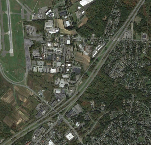
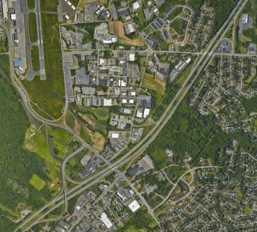
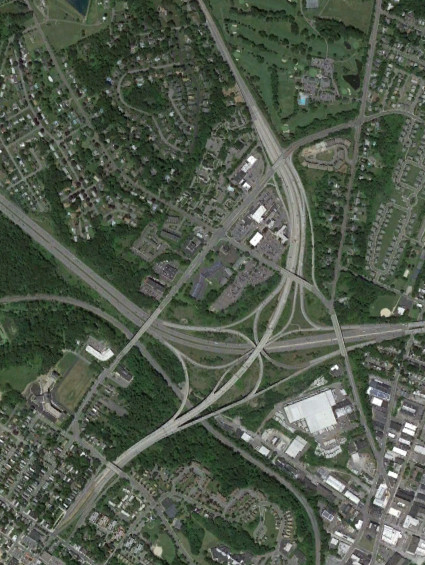
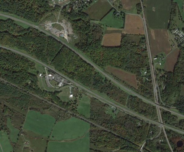
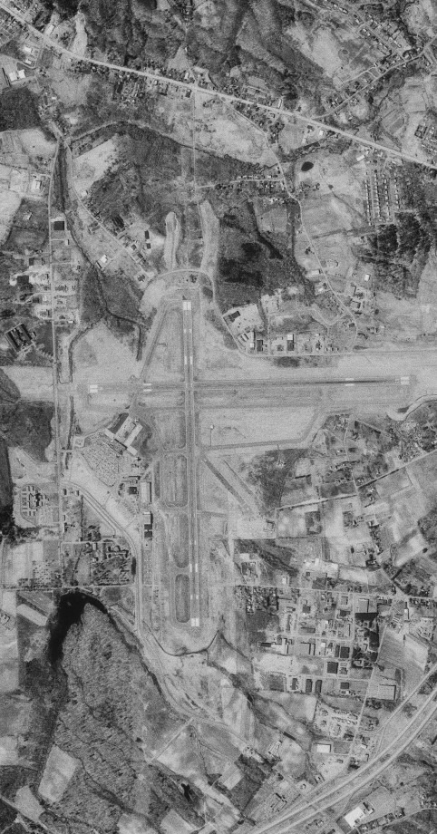
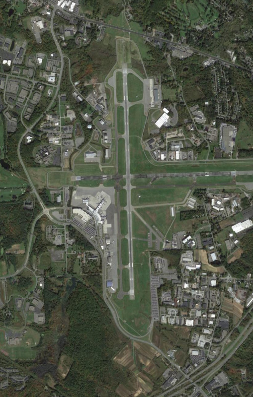
The area around NY 155 was modified in 2019 to provide better access to Albany International Airport. The original exits 4 and 5 had a southbound service road and exit 3 was absent, reserved for I-687, which would have paralleled Albany-Shaker Road and Sand Creek Road to end at I-90. This project built a new flyover ramp to bypass a couple of traffic lights with left turns, putting the exit 3 number into use. While the original plans for this upgrade would have removed the southbound exit 4 and made the northbound exit into only a right turn for Wolf Road, the project was modified to retain full access from both exit 3 and exit 4. The images above are from 2011 (top, Google) and 2022 (bottom, Google).
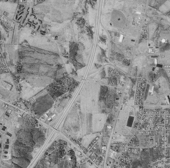
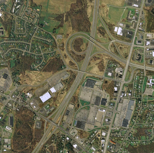

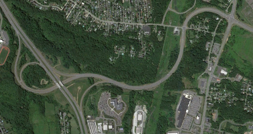
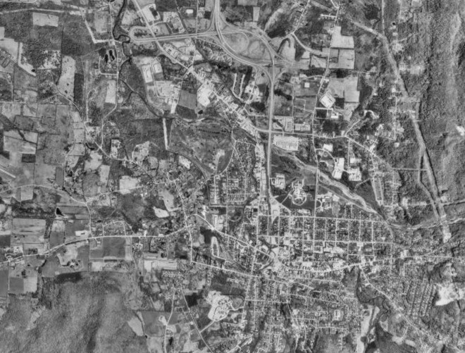
Like exit 3, exit 7 was originally reserved for an interstate that was not built - in this case, I-88. I-88 was intended to continue east past the Thruway (which it would have originally met at exit 25 for I-890) along the NY 7 corridor and follow what is now NY 7 to Troy, but was truncated to the Thruway with the money used instead to widen the Thruway and build exit 25A (which is why there are free movements on the Thruway in the area). While a pair of slip ramps to US 9 did get built, the exit 7 interchange that exits today was built with "Alternate Route 7", the only part of the originally envisioned I-88 east of the Thruway to be built. NY 7 was rerouted onto the freeway, with the old route becoming an extension of NY 2. The interchange with NY 7 and NY 2 was changed from a diamond to a single point urban interchange (SPUI) around 2010. The images above are from 1978 (top, USGS), 2007 (middle, Google/New York GIS), and 2020 (bottom, Google/Maxar Technologies).
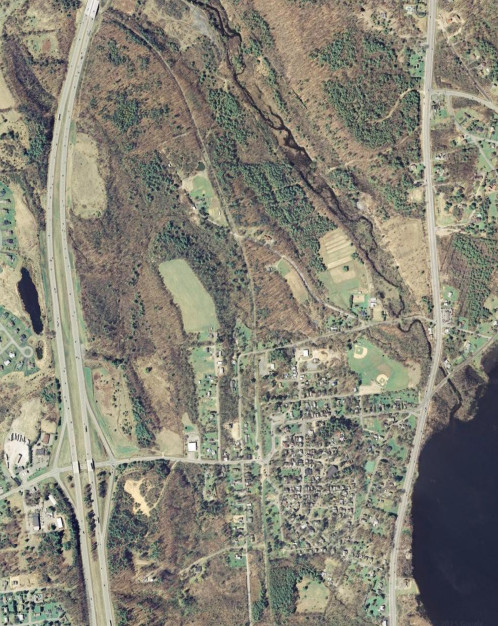
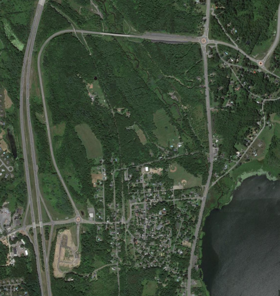
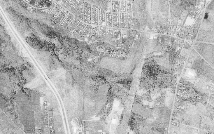
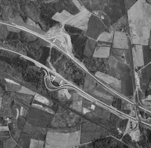
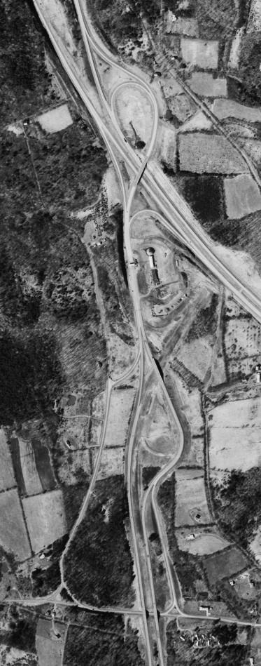
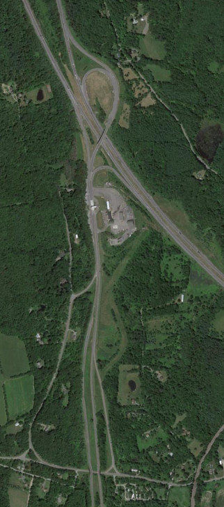
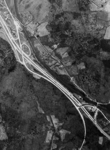
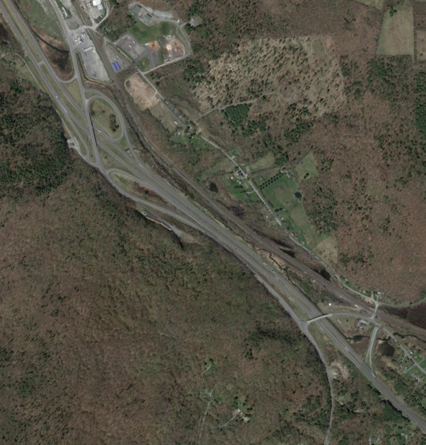
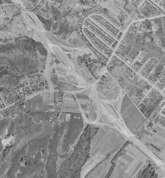
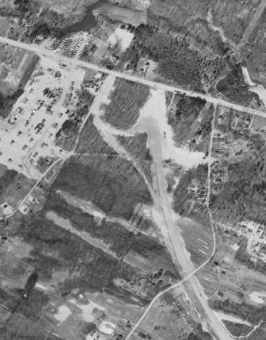
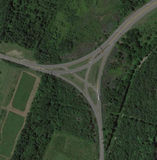
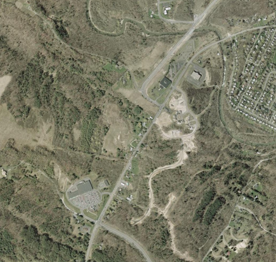
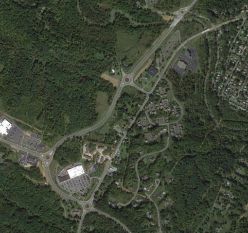
When Global Foundries came to Malta around 2010, access to I-87 needed to be improved. While there had been consideration for the construction of a new interchange between Round Lake and NY 67, instead the Round Lake Bypass (reference route 915J) was built to connect I-87 at the Round Lake exit with NY 67 at the eastern end of its overlap with US 9. The images above are from 2007 (top, Google/New York GIS) and 2015 (bottom, Google).

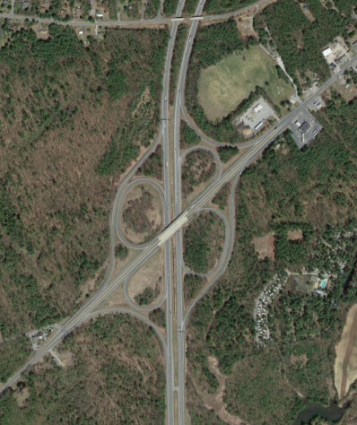
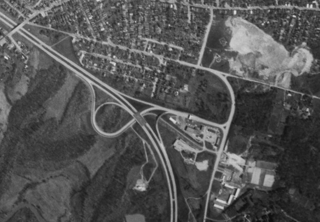
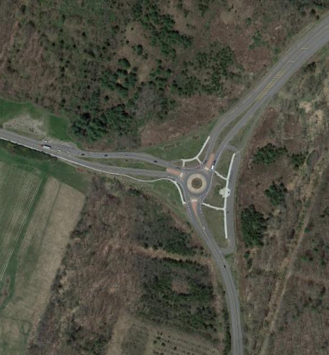
The NY 67 interchange was modified as part of a bridge replacement to include roundabouts, eliminating the need to build a wider bridge that included turn lanes. The images above are from 2004 (top, Google/USDA/FPAC/GEO) and 2013 (bottom, Google).
The interchange with US 9 in Moreau was modified in the 2022 as part of a bridge replacement project to eliminate the cloverleaf ramps and remove the unused capacity over the bridge (it had been four lanes through the interchange, but two lanes both north and soutgh of it). The images above are from 2015 (top, Google) and 2025 (bottom, Google/Airbus).
Interstate 90
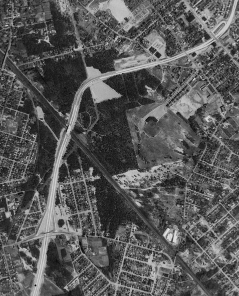
Washington Avenue originally led directly into the Thruway at exit 24 before the free section of I-90 was built around Albany. The original I-90/I-87 interchange was a cloverleaf, with the Northway intending to continue as the Southside Route parallel to the Thruway to I-787 at exit 23. The stub was later modified to include a loop ramp from US 20. In the late 1980s, the interchanges in the area were modified to provide better access to I-90 and I-87. The images above are from 1960 (top, USGS), 1978 (middle, USGS), and 2015 (bottom, Google).
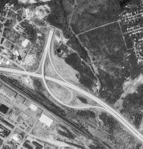
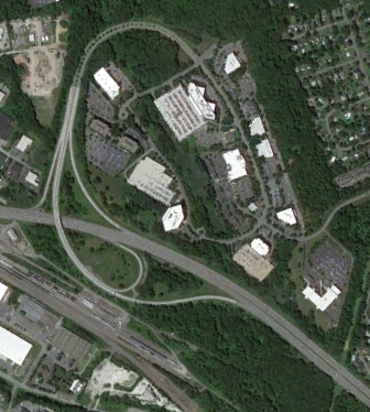
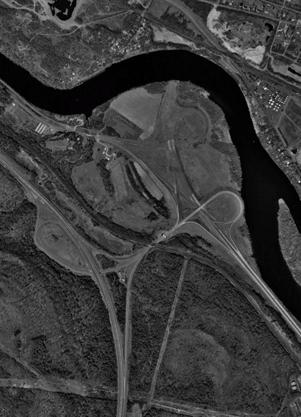
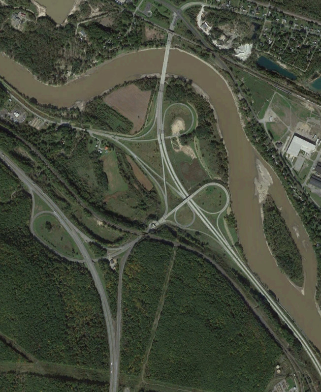
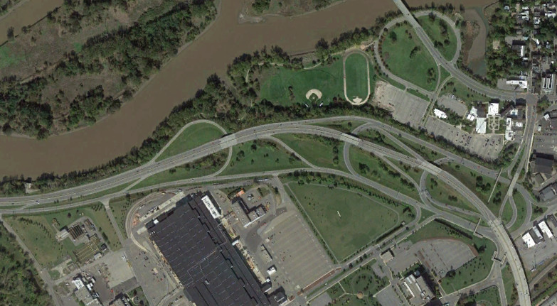
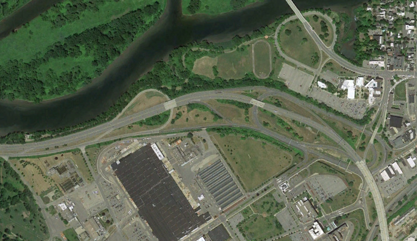
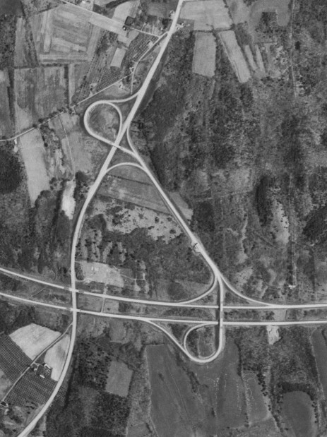
NY 85, the Crosstown Arterial, was intended to continue north to I-687, with the interchange with I-90 reflecting this. At some point, the loop ramp and stub were removed. The images above are from 1978 (top, USGS) and 2015 (bottom, Google).
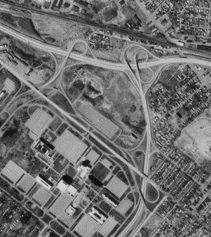
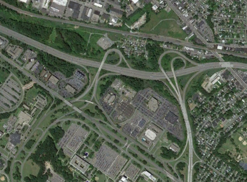
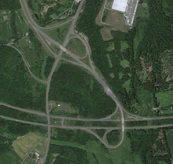
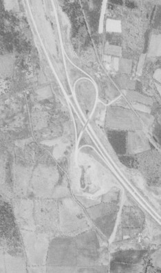
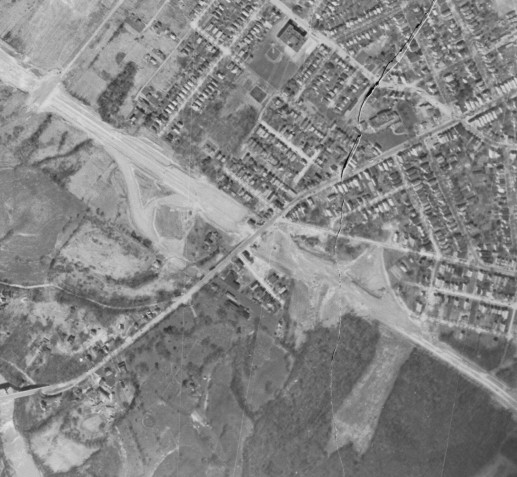
With I-687 never built, the interchange for it sat unused for many years before being repurposed for an office complex and Corporate Woods Boulevard. The images above are from 1978 (top, USGS) and 2015 (bottom, Google).
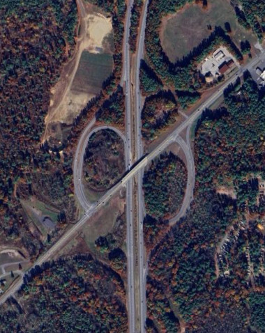
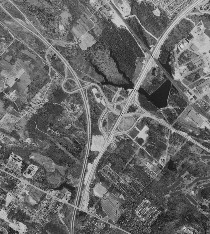
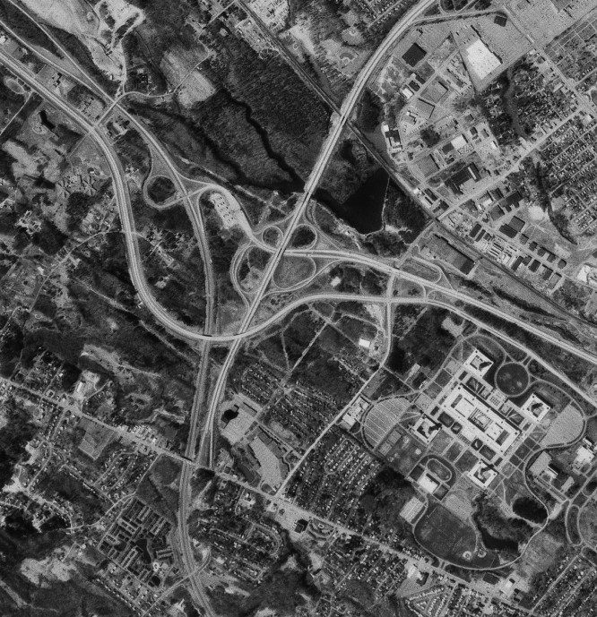
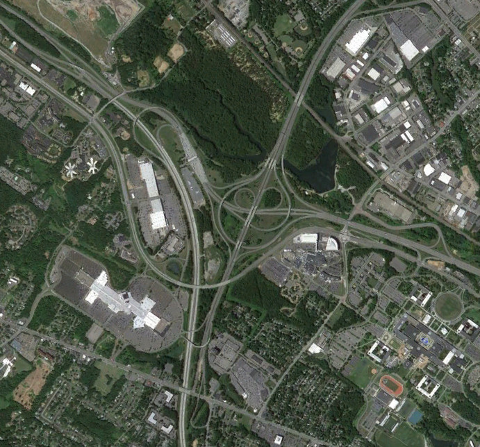
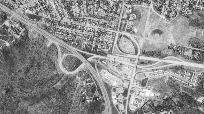
The only part of the Mid-Crosstown Arterial to be built was the stack interchange between I-90 and US 9, one of only three in the state (the other two are I-295 at Grand Central Parkway and I-90 at I-787 right next to this one). All traffic heading south is forced off the freeway onto Henry Johnson Boulevard via the stub ramp for Livingston Avenue. The image above is from 2015 (Google).
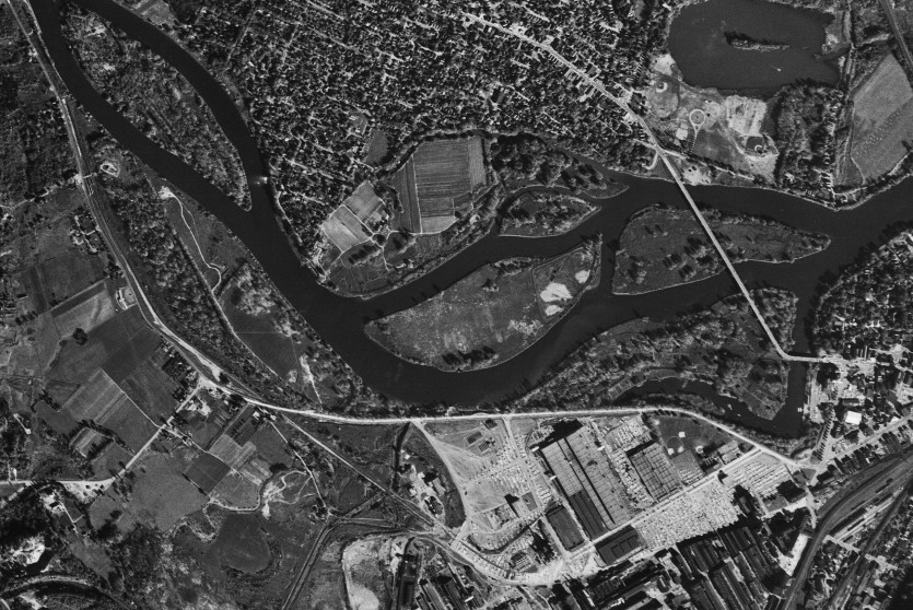
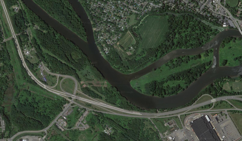
The South Mall Arterial was planned to continue east from the stub in Rensselaer and cross I-90 at a cloverleaf interchange before connecting to US 4. The area of the planned cloverleaf was repurposed for a connector from I-90 to US 4 and NY 43. A northern extension of the connector parallel to US 4 towards Troy was cancelled. The images above are from 1978 (top, USGS) and 2015 (bottom, Google).
Interstate 787

As originally built, Thruway exit 23 connected to US 9W; it was modified to connect to I-787 when the latter route was built. The I-787 mainline was supposed to flow into the Southside Route parallel to the Thruway connecting to the Adirondack Northway, and US 9W was supposed to feed directly into the Mid-Crosstown Artieral, with an interchange between the routes at this location; I-787 was later modified to have a smoother connection to US 9W. The images above are from 1960 (top, USGS), 1978 (middle, USGS), and 2015 (bottom, Google).
I-787 connects to the Port of Albany and Pearl Street via a pair of slip ramps to NY 32. Some Reimagine I-787 concepts move the Dunn Memorial Bridge south to tie into this location.
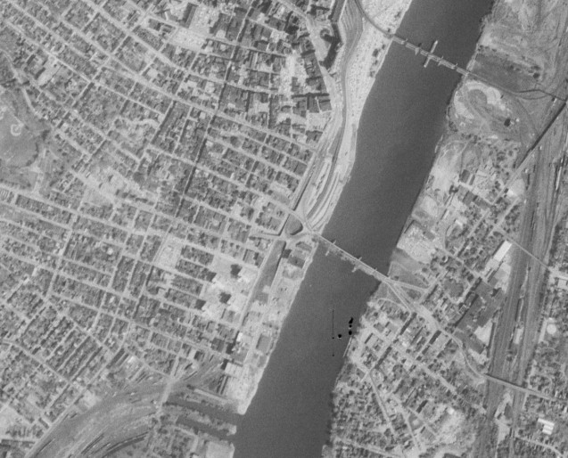
The original Dunn Memorial Bridge was replaced when I-787 was constructed, with the new bridge used for the South Mall Arterial. The image above is from 1960 (USGS).
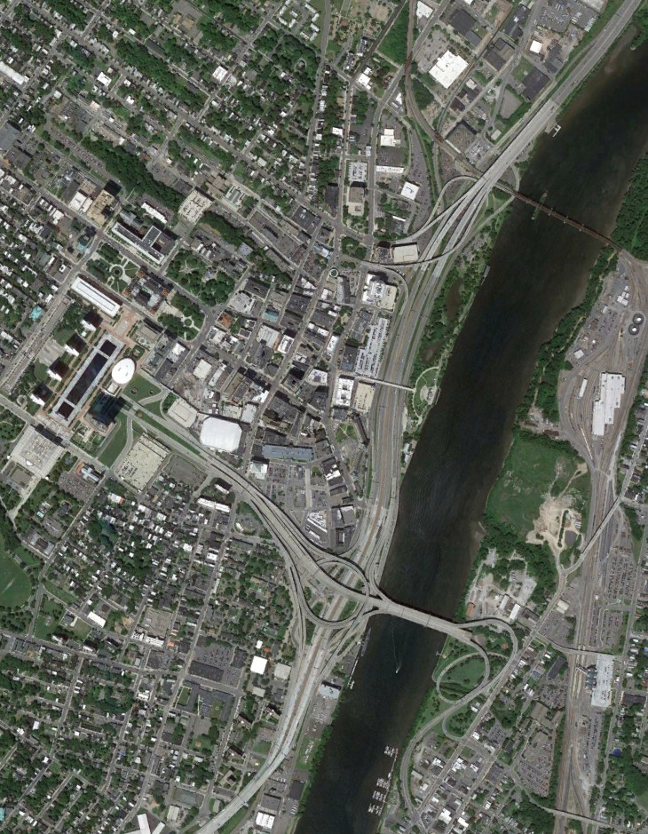
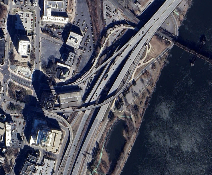
I-787 meets the South Mall Arterial (reference route 913V) in downtown Albany at the circle stack interchange. The South Mall Arterial was planned to continue in both directions - to the west, it would have gone under Empire State Plaza to end at an underground interchange with the Mid-Crosstown Arterial, and to the east, it would have connected with I-90 and US 4. Had it been completed, the South Mall would have likely carried the US 9 and NY 43 designations, with the Mid-Crosstown carrying US 9 and US 9W.
I-787 through here is being studied with some concepts turning it into a boulevard. All concepts remove the circle stack and the South Mall Arterial, replacing it with a surface street. The image above is from 2015 (Google).
An early effort to reimagine I-787 can be seen in what used to be the northbound flyover of US 9 as it passed over the surface parking lots and under I-787 into the Albany Skyway, a connection for bicycles and pedestrians across I-787 to Corning Riverfront Park. This entailed a reroute of US 9 north onto local streets through the area. The Skyway will also connect into the multi-use path along the new Livingston Avenue Bridge, which carries the Amtrak line across the Husdon River. The image above is from 2024 (Google/Airbus).
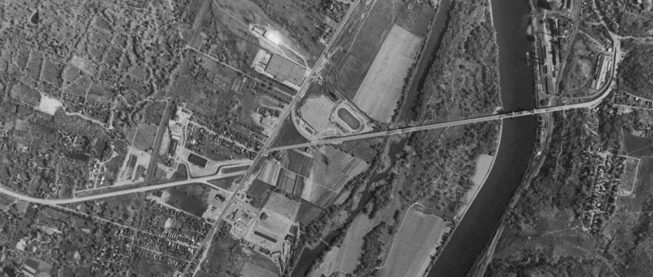
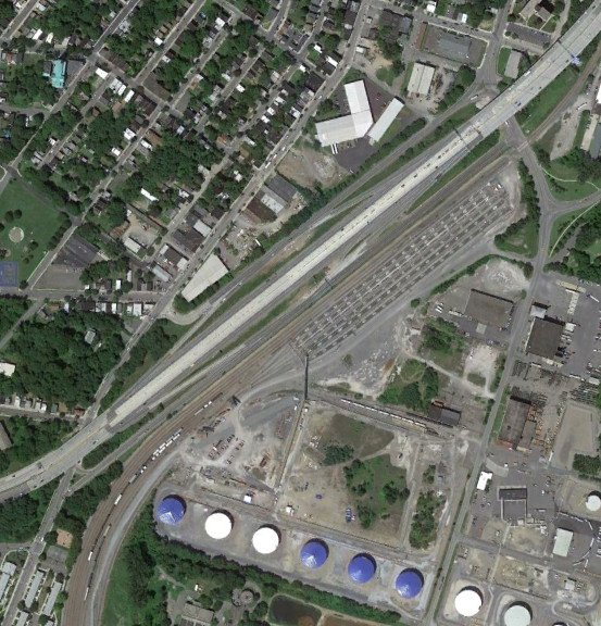
NY 378 acts as a freeway leading up to the Troy-Menands Bridge where it intersects with I-787, with the NY 32 interchange being built around the same time. The bridge is being studied for replacement, with concepts for different bridge locations and downgrading the freeway approach. The images above are from 1960 (top, USGS) and 2015 (bottom, Google).
Interstate 890/NY 890
Exit 26 of the Thruway originally connected to NY 5S. The western portion of I-890 was built on the NY 5S alignment and opened in 1974. I-890 then flowed into NY 5S at the Thruway interchange. The crossing over the Mohawk River was already planned at this point, but NY 890 wasn't completed until 1998. The images above are from 1959 (top USGS), 1995 (middle, Google/U.S. Geological Survey), and 2011 (top, Google).
I-890 was built to NY 337 in 1967, replacing NY 5S, and west of there in 1974. The images above are from 1959 (top, USGS) and 2015 (bottom, Google).
Around GE, I-890 was built with an interchange that had two loops to direct traffic. In 2016, the inner loop was remove to reduce the weaving distance for traffic coming from Schenectady and Scotia to I-890 east, removing a bridge on I-890 in the process. The interchange is being studied for potential further modification to move traffic away from Washington Avenue near SUNY Schenectady County Community College. The images above are from 2011 (top, Google) and 2018 (bottom, Google).

The first portion of I-890 to open was from the Thruway at exit 25 to where NY 7 splits off. At the time, I-890 went straight into NY 7, and the interchange at High Bridge Road was a half diamond. The images above are from 1960 (top, USGS) and 2015 (bottom, Google).
New York State Thruway
When it was built, the Berkshire Spur to the Thruway had a pair of service areas just west of exit B1. These service areas were abandoned due to low traffic, with a large number of people bypassing this section of Thruway via I-90 through Albany. The images above are from 1960 (top, USGS) and 2011 (bottom, Google).
Exit B1 was constructed to service US 9 and modified to tie into the eastern end of the free section of I-90 around the Albany area. The images above are from 1960 (top, USGS) and 2015 (bottom, Google).
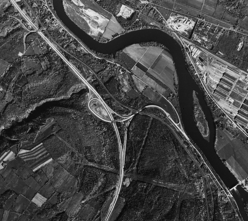
Exit B2 was always intended for the Taconic State Parkway, and didn't lead anywhere else prior to the Parkway being built in Columbia County. The Parkway was intended to continue further north, however those plans were cancelled, and the double trumpet interchange modified to have the Taconic flow straight to the Thruway. The original plan is still evident via the single lane section southbound on what was the ramp to get onto the Parkway from the Thruway. The images above are from 1960 (top, USGS), 1981 (middle, USGS), and 2015 (bottom, Google).
When first constructed, exit B3 for NY 22 was a partial interchange, with exit 1 on the Massachusetts Turnpike (four miles to the east) providing the other movements. It was later modified to be a full interchange. The original western end of the Massachusetts Turnpike at MA 102 is also visible, which was used briefly while waiting for the Berkshire Spur of the Thruway to be built. The images above are from 1960 (top, USGS) and 2014 (bottom, Google).
The Thruway was originally intended to be a free road, before it was decided to use tolls and bonded money to accelerate construction. Construction had already begun on the section between exits 23 and 24, which would have had three interchanges. The images above are from 1952 and show the construction at the intended interchanges with Delaware Avenue (NY 443, then NY 43 - top, USGS), New Scotland Road (then NY 85 - middle, USGS), and Western Avenue (US 20 - bottom, USGS).
NY 23
NY 23 had a large Y intersection with NY 9G east of the Rip Van Winkle Bridge. This was modified into a roundabout when the sidewalk over the bridge was incorporated into the Hudson River Skywalk. The images above are from 2015 (top, Google) and 2022 (bottom, Google).
NY 85/Slingerlands Bypass
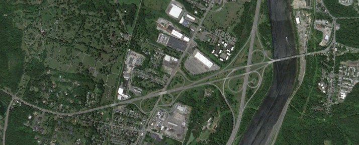
The NY 85 freeway was intended to continue southwest towards Voorheesville, however only the portion northeast of Slingerlands was built - and only as a two-lane section with an at-grade intersection from New Scotland Road to the City of Albany just past the Thruway. Around 2005, the Slingerlands Bypass was built to provide better access to NY 140. The images above are from 2001 (top, Google/New York GIS) and 2015 (bottom, Google).
VT 279/Bennington Bypass
The first part of the Bennington Bypass to be built was the connector from US 7 to VT 67A in the early 1970s. At the time, NY 7 continued straight to VT 9 rather than intersecting with the Bypass. The images above show NY 7 in 1995 (top, Google/U.S. Geological Survey) and the Bypass in 1993 (bottom, Google/U.S. Geological Survey).
The western section of the Bennington Bypass was opened in 2004, becoming VT 279 and New York reference route 915G. The eastern section was built in 2012 and the welcome center inside the US 7 interchange opened in 2013. The Bypass could potentially be extended southwest to meet US 7 south of downtown Bennington. The images above are from 2006 (top, Google/USDA/FPAC/GEO) and 2018 (bottom, Google).
Albany Shaker Road
The alignment of Albany Shaker Road has changed multiple times due to the expansion of Albany International Airport, which has also created a gap in Watervliet Shaker Road. The images above are from 1960 (top, USGS), 1978 (middle, USGS), and 2011 (bottom, Google).