
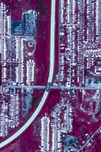
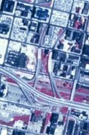
The Buffalo/Niagara Falls area had numerous cancelled expressways, the most visible of which is the stub ending of the LaSalle Expressway where it was planned to continue as the Belt Expressway (no relation to the Belt Parkway in Brooklyn and Queens). Also visible is exits 6 and 8 on I-190, which were intended to be the endpoints of the Kensington Expressway, the partial stub on I-990 where it would have continued north to Lockport, and the removed sections of the Niagara Scenic Parkway. On the map above, the only sections of proposed freeway/expressway to eventually be built are the Southern Expressway (US 219), the Aurora Expressway (NY 400), part of NY 425 (a divided highway), and part of the Lockport Expressway (I-990). The image above shows the existing and proposed freeway system for Buffalo/Niagara Falls in 1971, from a design report prepared by De Leuw, Cather & Company.
The freeway system has evolved over the years. Changes related to the Niagara Scenic Parkway and US 219 are on the associated articles; everything else is depicted here. The images below have been obtained from the U.S. Geological Survey (USGS) Eros Archive and Google Earth.
Contents
- Interstate 90/New York State Thruway
- Interstate 190/Niagara Thruway and ON 405
- Interstate 990/Lockport Expressway
- NY 5/Buffalo Skyway
- NY 33/Kensington Expressway
- NY 179/Mile Strip Road
- LaSalle Expressway
Interstate 90/New York State Thruway
Prior to the construction of I-290, exit 50 went to NY 5 near Williamsville. The images above are from 1958 (top, USGS) and 2018 (bottom, Google).
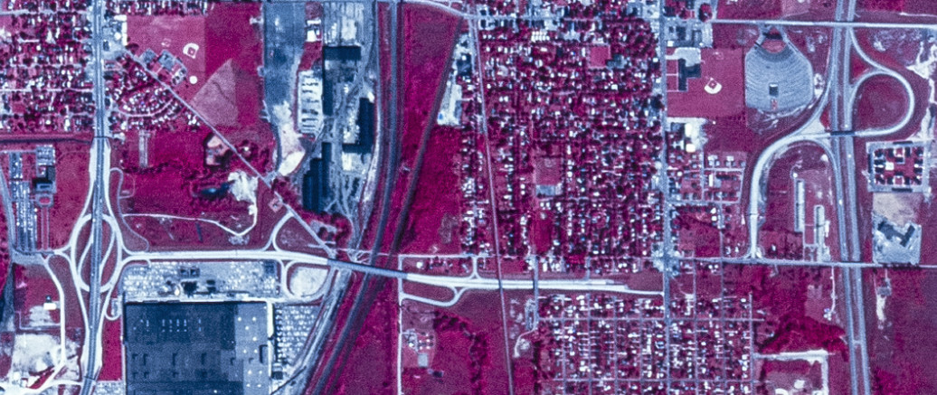
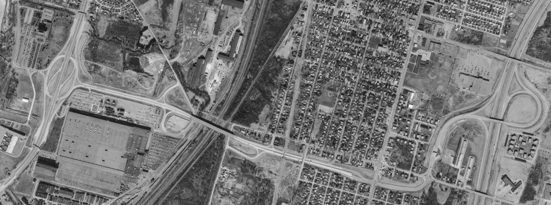
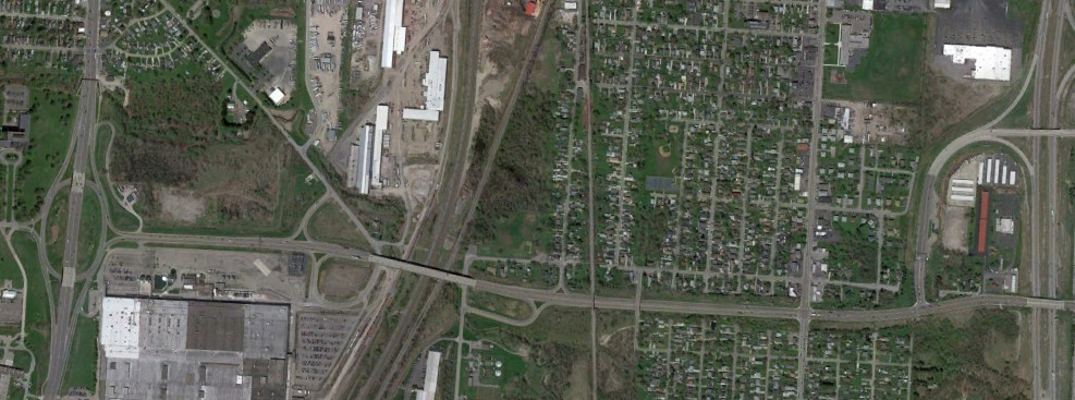
Prior to the construction of the Kensington Expressway, exit 51 served Maryvale Drive. The images above are from 1958 (top, USGS) and 2018 (bottom, Google).
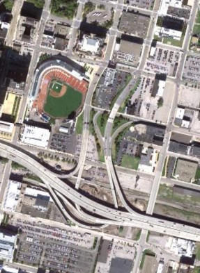
The Thruway did not originally have an interchange at William Street, which was built well after the Thruway opened. The images above are from 1972 (top, USGS) and 2018 (bottom, Goolge).
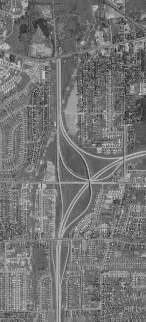
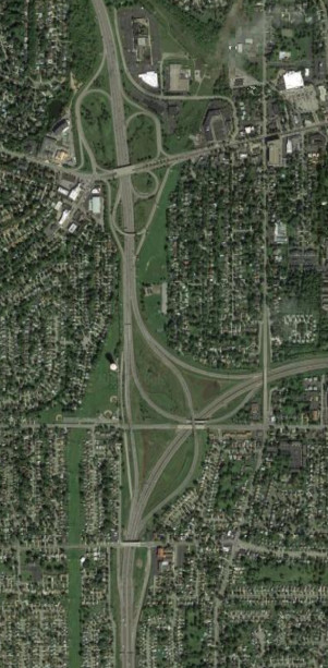
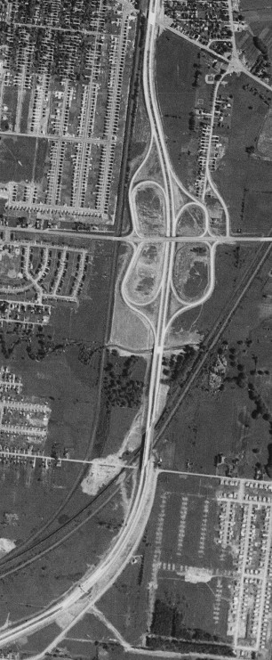
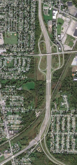
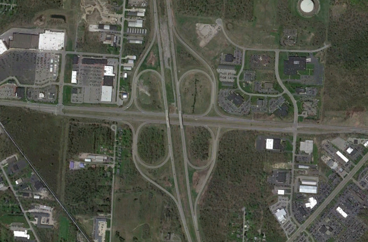
Prior to the construction of NY 400, exit 54 went directly to NY 16. The images above are from 1958 (top, USGS) and 2018 (bottom, Google).
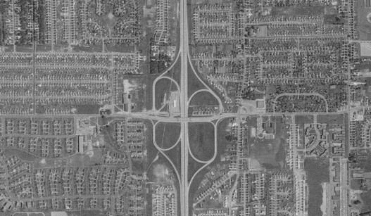
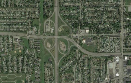
Prior to the construction of the US 219 freeway, exit 55 served Ridge Road directly rather than via US 219 traveling parallel to the Thruway. The images above are from 1958 (top, USGS) and 2011 (bottom, Google).
The Thruway interchange for Hamburg at NY 75 was modified to remove the trumpet on the NY 75 side and replace it with an at-grade intersection, reducing the amount of land used and eliminating the need to maintain the bridge. The images above are from 2011 (top, Google) and 2020 (bottom, Google).
Interstate 190/Niagara Thruway and ON 405
The interchange with Elm Street and Oak Street was designed to accomodate a connection to the Kensington Expressway that was never built. At some point, it was modified for the exit ramp to travel over Seneca Street with ramps to make the connection instead of an at-grade intersection. The images above are from 1972 (top, USGS) and 2011 (bottom, Google).
Like the interchange with Elm Street and Oak Street, the interchange with NY 266/Niagara Street was designed to accomodate a never-built connection to the Kensington Expressway. The image above is from 2011 (Google).
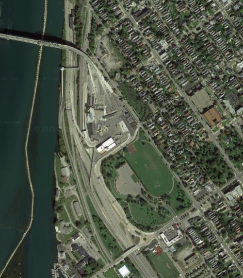
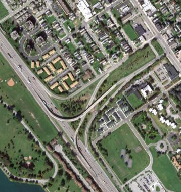
The interchange for the Peace Bridge was modified to eliminate the at-grade intersection before the Peace Bridge, increasing the park area in the process. The images above are from 2011 (top, Google) and 2018 (bottom, Google).
The South Grand Island Bridge was originally a single bridge and part of NY 324. It was later incorporated into the Niagara Thruway (I-190) and twinned shortly thereafter. The images above are from 1958 (top, USGS) and 2011 (bottom, Google).
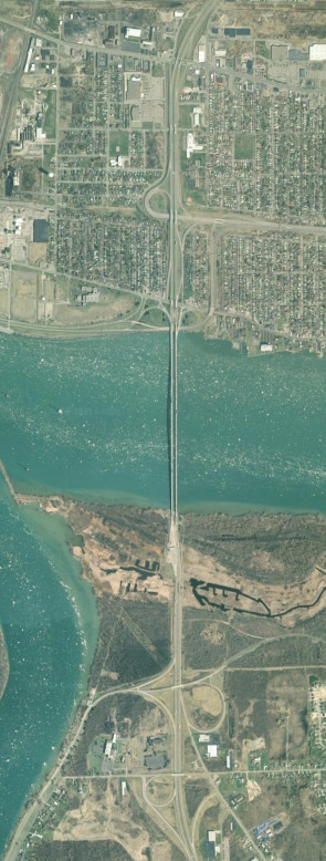
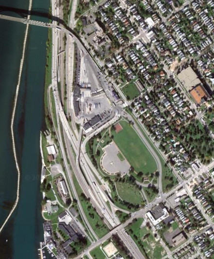
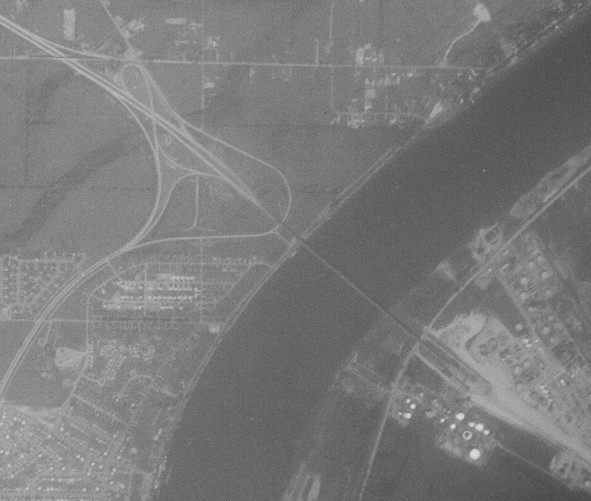
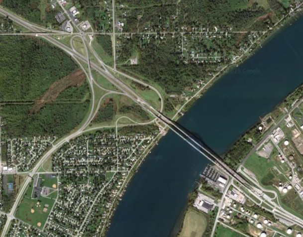
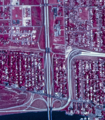
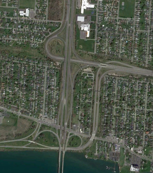
Like the South Grand Island Bridge, the North Grand Island Bridge was originally a single bridge carrying NY 324 before being incorporated into the Niagara Thruway (I-190) and twinned shortly therafter. Additional ramps were added to the NY 324 interchange as well. The Niagara Thruway ends here; I-190 continues as a NYSDOT roadway to Canada. The images above are from 1958 (top, USGS) and 2009 (bottom, Google/U.S. Geological Survey).
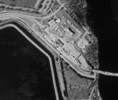
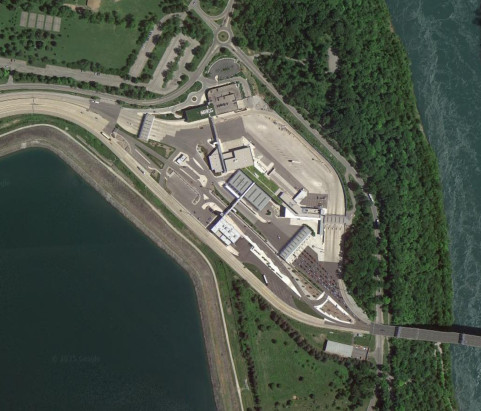
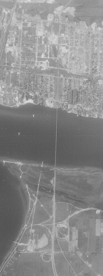
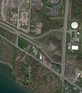
I-190 ends at the Canadian border on the Lewiston-Queenston Bridge and is continued into Ontario by the ON 405 freeway, connecting it to the QEW (Queen Elizabeth Way). ON 405 originally had an interchange with Niagara River Parkway, which was eliminated to expand the customs area and provide a truck queuing area approaching the US. The images above are from 1995 (top, Google/U.S. Geological Survey) and 2014 (bottom, Google).
Interstate 990/Lockport Expressway
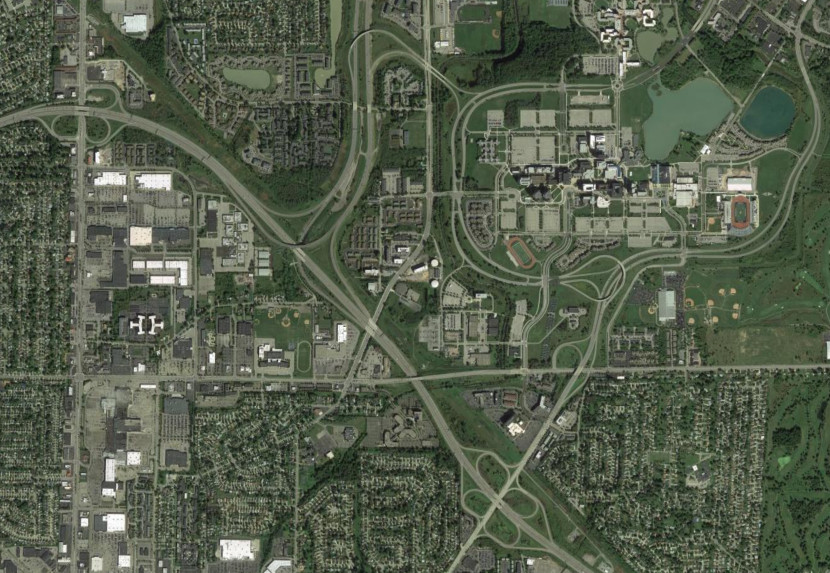
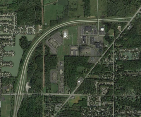
I-990 was built after the other interstates and freeways around Buffalo, around the same time when the modern alignment of NY 263 was built around SUNY Buffalo in the early 1980s. The images above are from 1971 (top, USGS) and 2018 (bottom, Google).
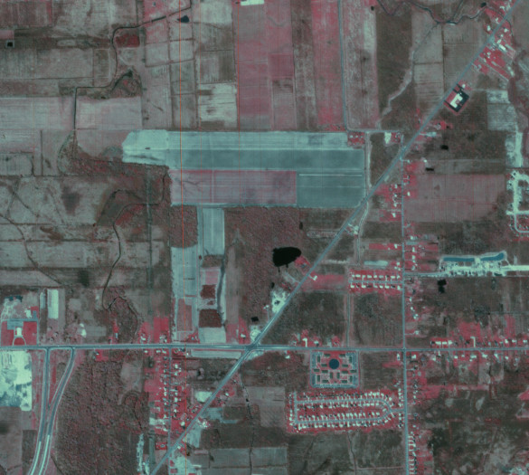
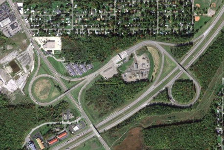
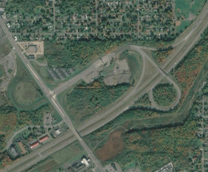
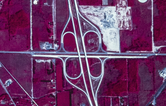
When I-990 was first built, it only extended to French Road. It was shortly extended a mile further to provide direct access to NY 263 (Millersport Highway). The images above are from 1985 (top, USGS) and 2018 (bottom, Google).
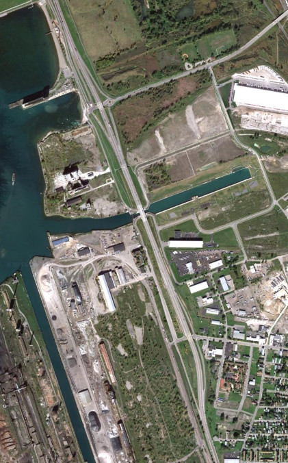
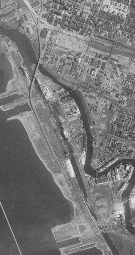
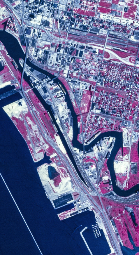
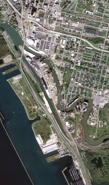
NY 5/Buffalo Skyway
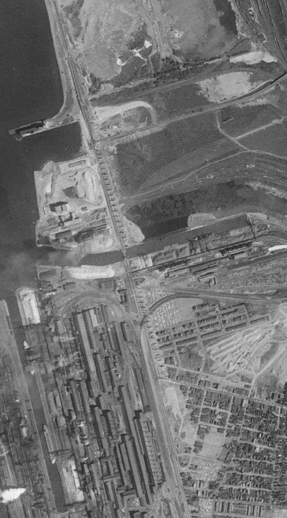
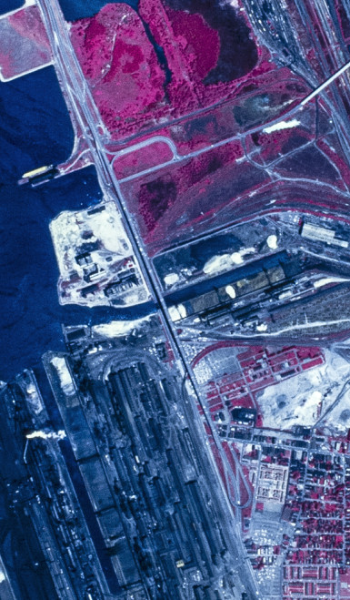
The freeway leading to the Buffalo Skyways was built in the 1950s and 1960s. The southern end of the freeway, particularly the interchange with Tifft Street, has been modified multiple times. The images above are from 1958 (top, USGS) and 1972 (middle, USGS).
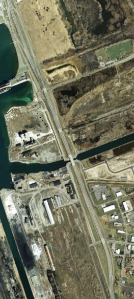
The Tifft Street interchange was modified first to tie in more cleanly with the service roads, and then again to eliminate the northbound service road. The images above are from 2005 (top, Google/New York GIS) and 2011 (bottom, Google).
When first built, the Buffalo Skyway led into Fuhrmann Boulevard prior to the construction of the rest of the freeway leading up to it. The interchanges were modified again with the elimination of the northbound service road. The images above are from 1958 (top, USGS), 1972 (middle, USGS), and 2011 (bottom, Google).
NY 33/Kensington Expressway
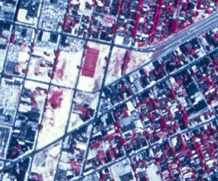
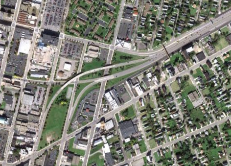
The western end of the Kensington Expressway originally went directly into Goodell Street, with the intent for an interchange to be built splitting it into two alignments connecting to I-190, one at the interchange with Elm Street and Oak Street, and the other at the interchnge with NY 266/Niagara Street. Those plans were cancelled, and eventually the ramps providing the direct connections to Oak Street and Elm Street were built. The images above are from 1972 (top, USGS) and 2011 (bottom, Google).
NY 179/Mile Strip Road
The NY 179 freeway was intended to be the southern end of an outer loop around Buffalo which was never built. It originally ended at a stub at US 62, which was later modified to have an at-grade connector road with the Thruway interchange, and then again to continue into Mile Strip Road. Two ramps from NY 5 were also eliminated. The images above are from 1972 (top, USGS), 1983 (middle, USGS), and 2022 (bottom, Google).
The only other part of the proposed outer loop of Buffalo built along NY 179 is at the US 219 interchange, where both directions of the intended freeway were built. They were modifided at some point to provide smoother movements for eastbound traffic and facilitate development. The images above are from 1972 (top, USGS) and 2022 (bottom, Google).
LaSalle Expressway
Officially, the LaSalle Expressway follows the ramps to the Niagara Scenic Parkway, where they end at each other near Stephenson Avenue. This seems unusual, but is likely because the connection to I-190 was built after the rest of the LaSalle Expressway, which was at one point proposed to extend west into Niagara Falls to end at the Rainbow Bridge. The images above are from 1972 (top, USGS) and 2022 (bottom, Google).
Like the NY 179 freeway, the LaSalle Expressway was intended to be part of a proposed outer loop of Buffalo. The only evidence of this is the stub ending at Williams Road. The image above is from 2022 (Google).