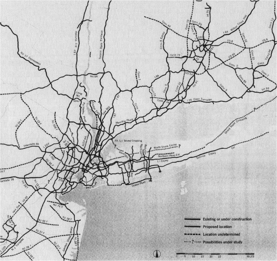
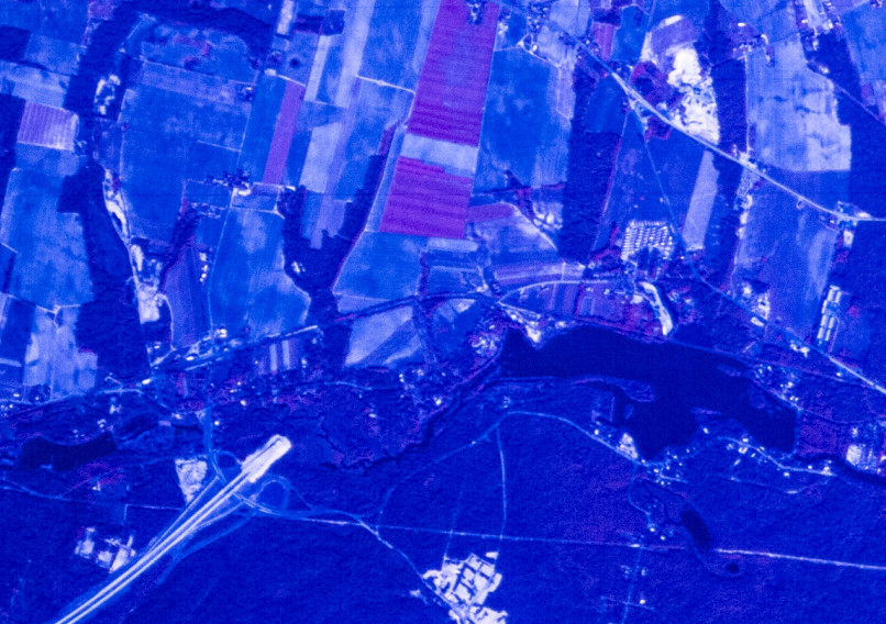
Long Island had some planned corridors that were not built, including an extension of the Long Island Expressway and most of the Babylon-Northport Expressway. This is shown through the stub endings for I-495 and NY 135. The image above is from a 1964 report developed by the Tri-State Transportation Comission and published in the May 1964 edition of Regional Plan Association News, available on Steve Anderson's NYCRoads.com.
The system has evolved over the years, including upgrading much of NY 27 to an expressway. The images below have been obtained from the U.S. Geological Survey (USGS) Eros Archive and Google Earth.
Contents
- Interstate 495/Long Island Expressway
- NY 27/Sunrise Highway
- NY 135/Seaford-Oyster Bay Expressway
- Meadowbrook State Parkway
- Northern State Parkway
- Southern State Parkway
- Sunken Meadow State Parkway
- CR 97/Nicolls Road
Interstate 495/Long Island Expressway
The interchange with Glen Cove Road was modified from a cloverleaf into a parclo, with a couple ramps moved to increase merging space on the service roads. The images above are from 1969 (top, USGS) and 2015 (bottom, Google).
The interchanges with NY 25 as well as NY 106 and NY 107 were modified into full interchanges as the service roads were completed. The images above are from 1969 (top, USGS) and 2012 (bottom, Google).
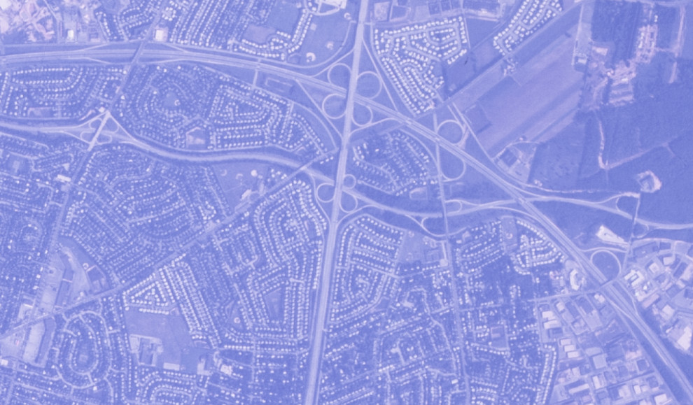
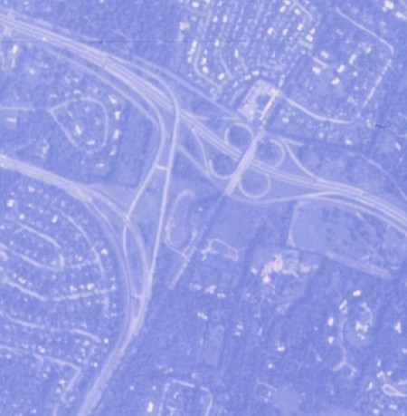
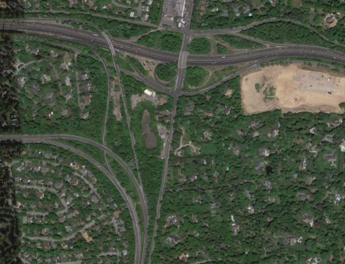
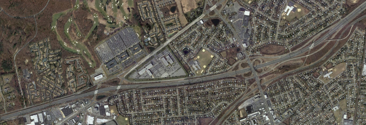
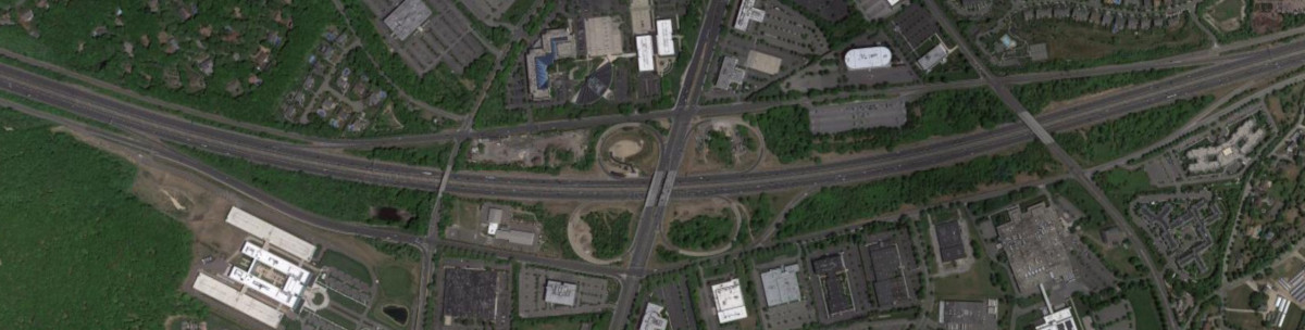
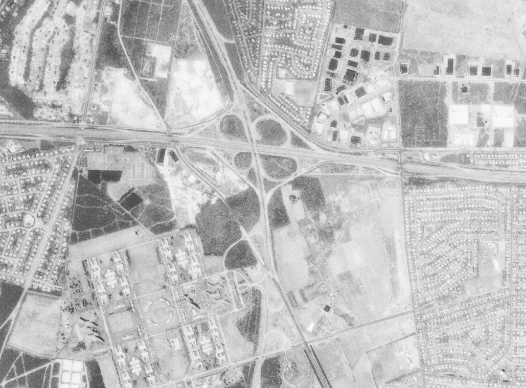
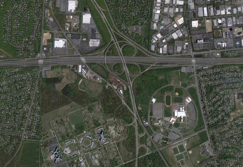
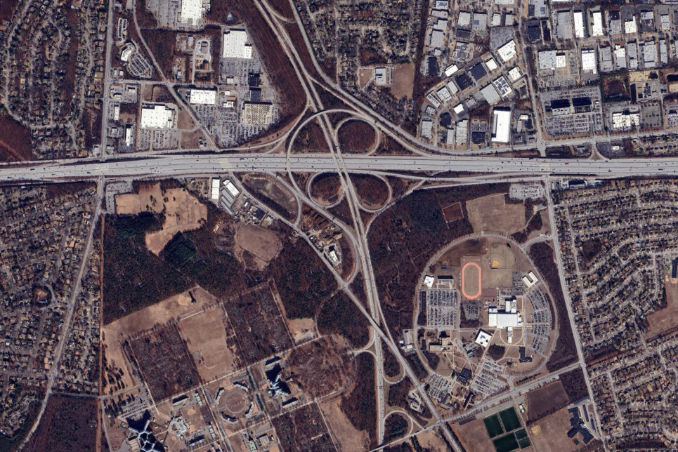
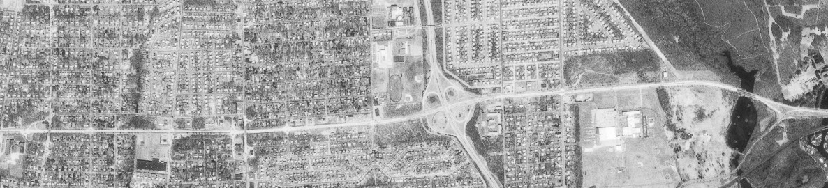
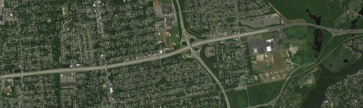
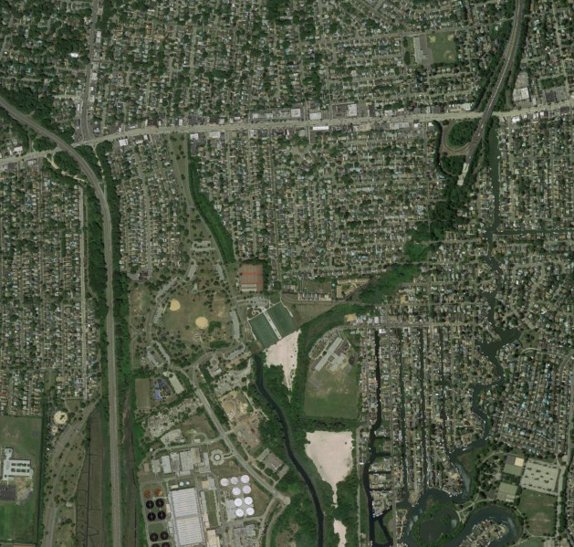
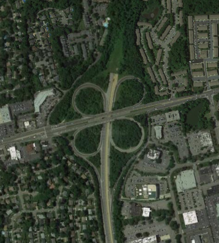
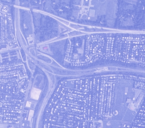
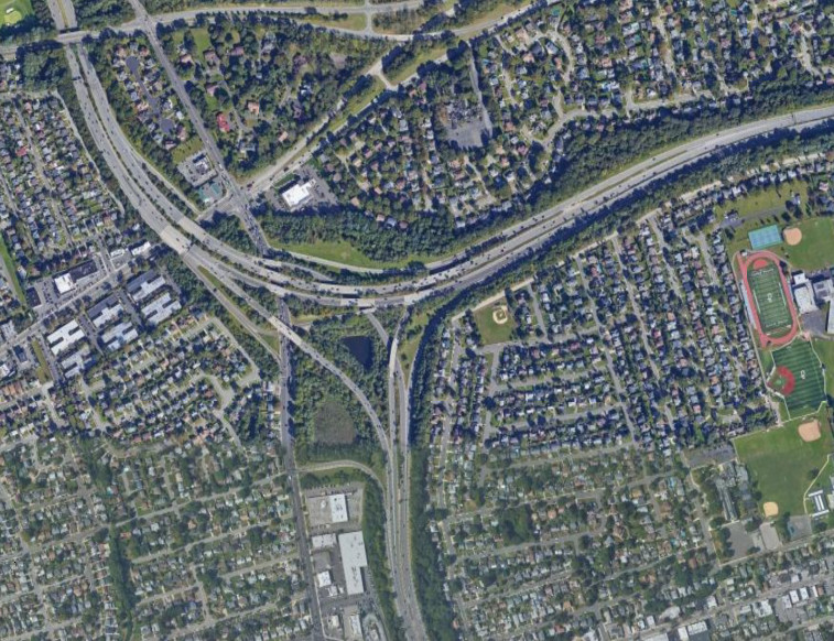
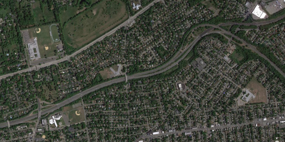
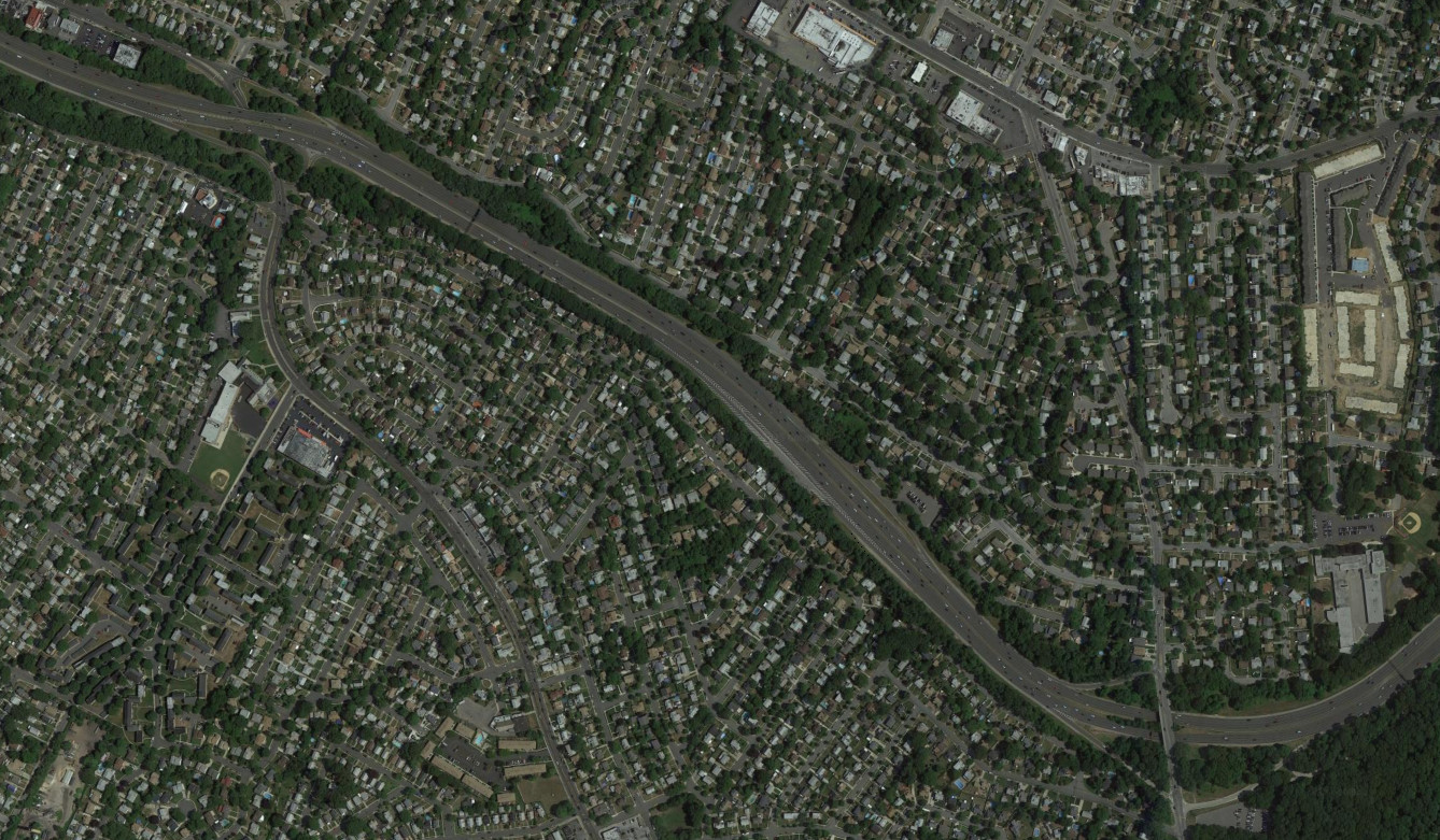
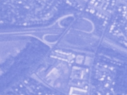
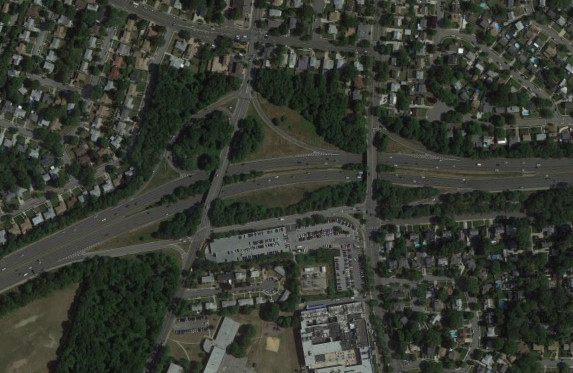
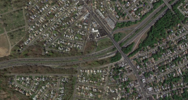
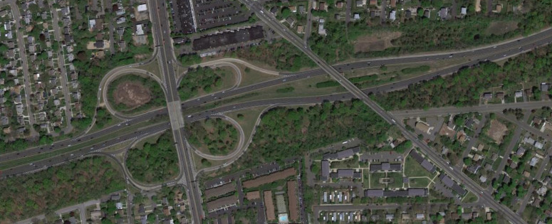
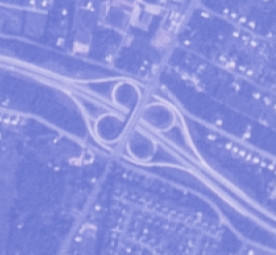
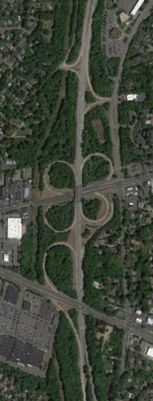
Many interchanges along I-495 and also along the Northern State Parkway were modified over the years in the area around NY 135. The images above are from 1969 (top, USGS) and 2012 (bottom, Google).
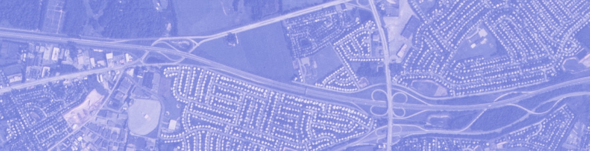
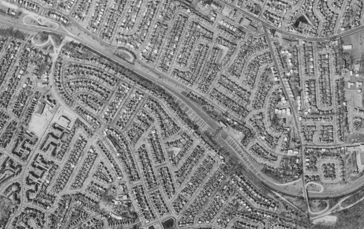
The interchange with NY 110 was modified as the service roads were extended, vastly increasing the footprint of the interchange. The images above are from 1969 (top, USGS) and 2015 (bottom, Google).
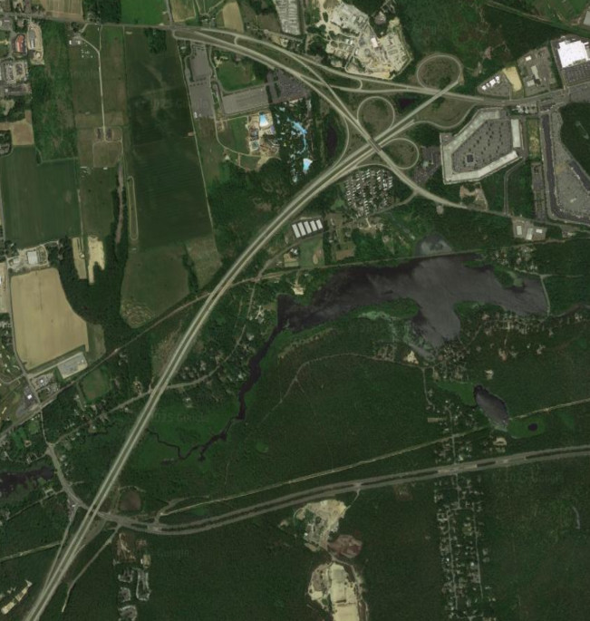
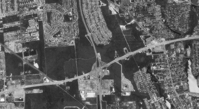
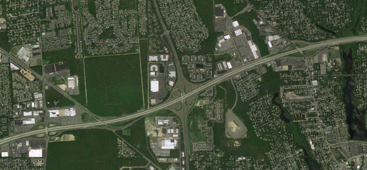
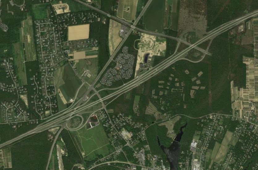
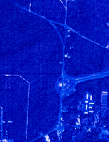
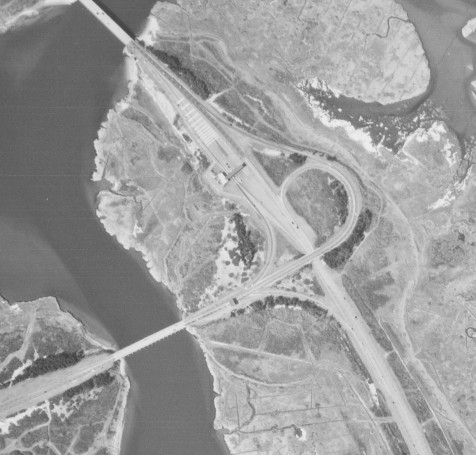
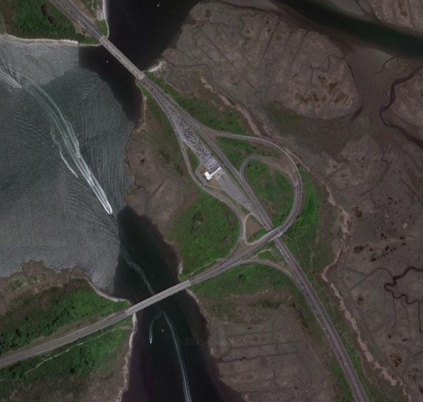
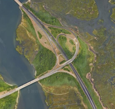
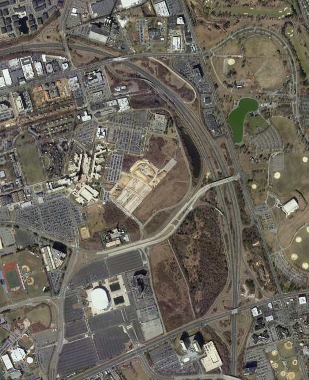
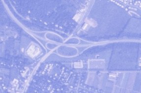
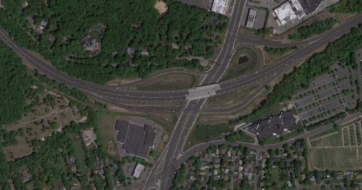
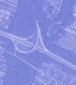
The junction between I-495 and the Sagtikos State Parkway has seen modification. Originally it was a cloverleaf, and modifed to add a flyover and incorporate the LIE service roads. It was modified again to provide additional access to Crooked Hill Road from I-495. The images above are from 1980 (top, USGS), 2016 (middle, Google), and 2025 (bottom, Google/Airbus).
The LIE once ended at the NY 24 interchange before being extended to NY 25 and CR 58. The LIE was planned to extend further east, potentially even to an eastern crossing of the Long Island Sound. The images above are from 1969 (top, USGS) and 2014 (bottom, Google).
NY 27/Sunrise Highway
NY 27 was upgraded to a freeway more recently than the other expressways on Long Island. The images above show NY 27 in Islip from Brentwood Road to NY 111 and are from 1980 (top, USGS) and 2014 (bottom, Google).
The images above show NY 27 in East Islip from NY 111 to NY 27A (including the interchange with the Southern State Parkway and Heckscher State Parkway) and are from 1980 (top, USGS) and 2014 (bottom, Google).
Sunrise Highway was originally a divided highway east of Oakdale and was upgraded into a freeway. The images above show it around Patchogue from Broadway Avenue to Waverly Avenue (including the ramps with NY 454 and CR 97) and are from 1980 (top, USGS) and 2014 (bottom, Google).

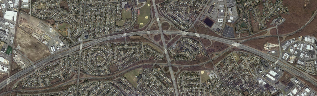
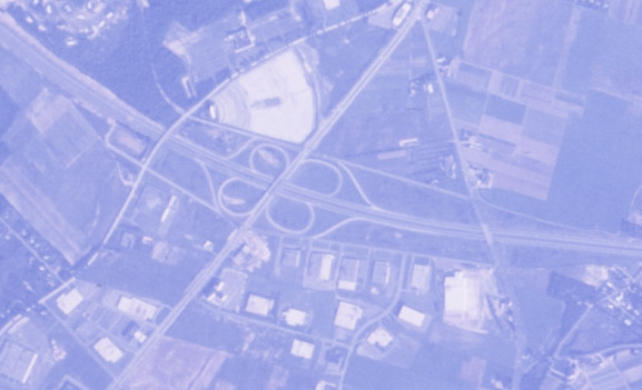
Sunrise Highway had a gap from CR 51 to NY 24 initially before the freeway connection was built. The interchanges show planned expansion, with accomodations for service roads which have not been built and an eastern extension of CR 111. The images above are from 1969 (top, USGS) and 2014 (bottom, Google).
Sunrise Highway had a stub before the gap in the freeway filled in and eventually a cloverleaf was built at NY 24. The images above are from 1969 (top, USGS) and 2014 (bottom, Google).
NY 135/Seaford-Oyster Bay Expressway
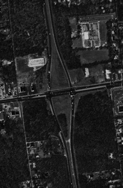
NY 135 has stubs at both ends for planned extensions that were never built. On the south end, NY 135 was originally planned to end at the Wantagh State Parkway rather than Merrick Road. NYSDOT cleared out the right of way for the route, but it was never constructed and the ROW was eventually sold to Nassau County. The images above are from 2014 and show the stub interchagne at Merrick Road (top, Google) and the ROW for the southern extension (bottom, Google).
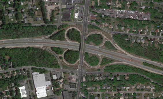
On the north end, NY 135 was planned to continue from NY 25 to NY 106 at Oyster Bay via a route around Syosset. The plans for the expressway were further expanded to have it cross the Long Island Sound to end at the New England Thruway and I-287, with the route to be an extension of I-287. These plans were cancelled due to public opposition and the designation of a bird sanctuary and a protected park in the area of the proposed expressway. The image above is from 2014 (top, Google).
Meadowbrook State Parkway
The southern terminus of the Meadowbrook State Parkway and the western terminus of the Ocean Parkway at the interchange with the Bay Parkway was modified into a cloverlead and the Ocean Parkway modified into a divided highway. The images above are from 1966 (top, USGS) and 2015 (bottom, Google).
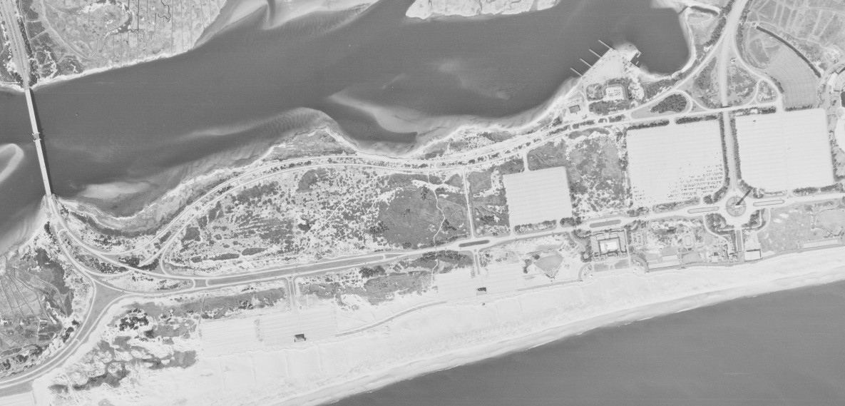
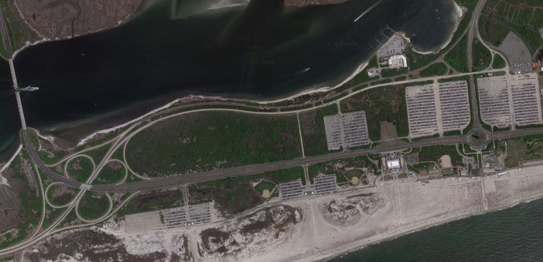
The interchange with the Loop Parkway has been modified multiple times, first to provide access bypassing the fee booths for Jones Beach State Park, and then again when the fee booths along the parkway were removed. The images above are from 1966 (top, USGS), 2015 (middle, Google), and 2022 (bottom, Google).
The interchange with NY 24 was modified to provide access to Charles Lindberg Boulevard. The images above are from 1969 (top, USGS) and 2012 (bottom, Google).
Northern State Parkway
The interchanges from the Northern State Parkway to Glen Cove Road and the Meadowbrook State Parkway were modified to reduce weaving and eliminate the loop ramps. The images above are from 1969 (top, USGS) and 2018 (bottom, Google).
The interchange with Post Avenue was modified to eliminate the loop ramps and the northern terminus of the Wantagh State Pakrway was modified to eliminate the loop ramps with Brush Hollow Road. The images above are from 1969 (top, USGS) and 2015 (bottom, Google).
The interchange with NY 110 was modified to eliminate most of the loop ramps. The images above are from 1969 (top, USGS) and 2015 (bottom, Google).
Southern State Parkway
The interchange with Central Avenue and Linden Boulevard was modified to remove most of the loop ramps; the interchange with Fletcher Avenue was also modified to remove the loop ramps. The Southern State Parkway also used to be a toll road; the toll was removed in 1978. The images above are from 1966 (top, USGS) and 2010 (bottom, Google).
The interchange with Corona Avenue was modified to remove most of the loop ramps and to provide access to Franklin Avenue. The images above are from 1969 (top, USGS) and 2010 (botoom, Google).
The interchange with Nassau Road was modified to eliminate the cloverleaf design and incorporate Bookside Avenue. The images above are from 1969 (top, USGS) and 2016 (bottom, Google).
The interchange with the Bethpage State Parkway was modified to improve access with Linden Street. The images above are from 1969 (top, USGS) and 2015 (bottom, Google).
The Southern State Parkway originally had a service area in the median just east of NY 110, under the CR 47 overpass; it was closed in 1985. The images above are from 1969 (top, USGS) and 2016 (bottom, Google).
The interchange with CR 13 was modified to have some of the ramps terminate at the roads paralleling the parkway rather than merge into CR 13 right on top of the intersections. The images above are from 1969 (top, USGS) and 2015 (bottom, Google).
Sunken Meadow State Parkway
The interchange on the Sunken Meadow State Parkway at NY 25 was modified to provide access from the northbound parkway to Indian Head Road. The images above are from 1969 (top, USGS) and 2015 (bottom, Google).
CR 97/Nicolls Road

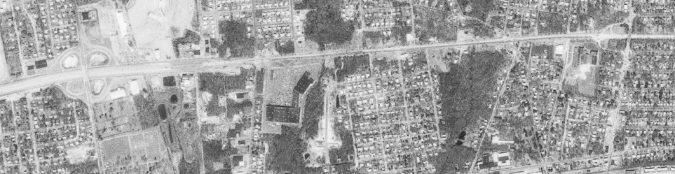
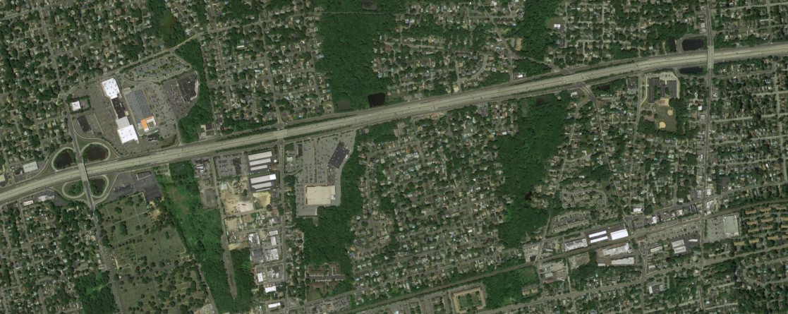
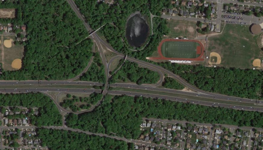
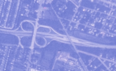
Suffolk CR 97 is an interesting case of a county route with freeway interchanges. A notable case is where the intersection with NY 25 was upgraded into the first single point urban interchange (SPUI) in the state. The images above are from 1994 (top, Google/U.S. Geological Survey) and 2016 (bottom, Google).