New York's North Country region may not have any of the most major population centers or a large freeway system, however its roadway network has certainly evolved over the last few decades.
The images below have been obtained from the U.S. Geological Survey (USGS) Eros Archive and Google Earth.
Contents
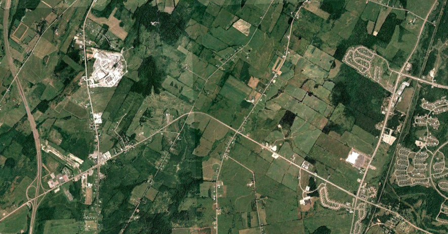
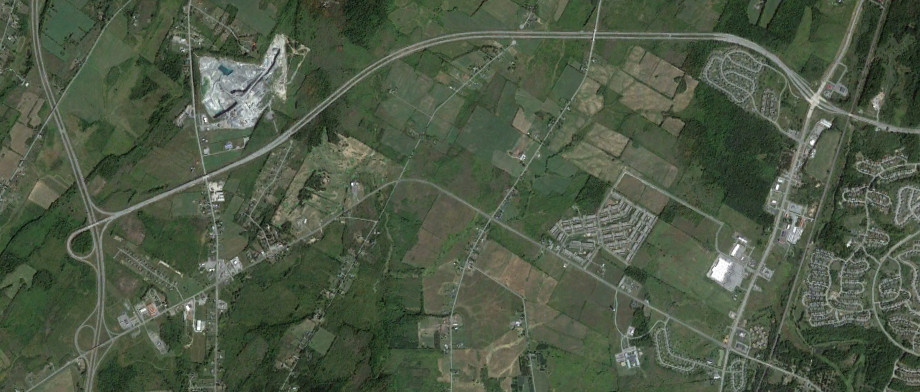
Interstate 81 and ON 137
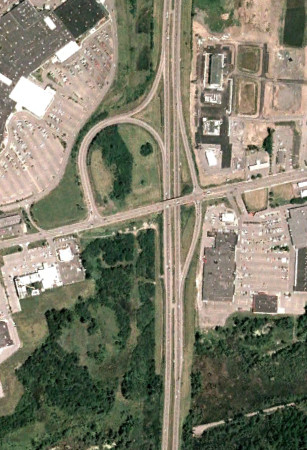
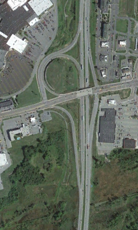
The interchange between I-81 and NY 3 was reconfigured around 2008 in order to ease traffic on NY 3. The images above are from 2006 (top, Google/USDA/FPAC/GEO) and 2016 (bottom, Google).
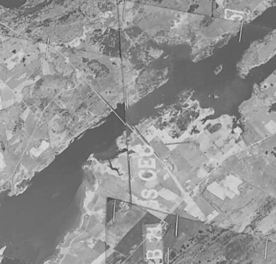
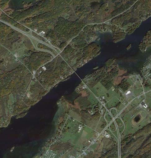
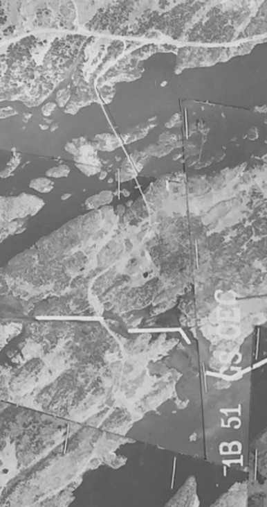
The Thousand Islands Bridge was completed in 1938 and originally connected NY 12 to the Thousand Islands Parkway via Jefferson CR 191 on Wellesley Island and what is now ON 137 on Hill Island. Interstate 81 was completed south of the bridge in 1965 and on Wellesley Island in 1970. The images above are from 1958 (top, USGS) and 2013 (bottom, Google).
ON 137 was designated on the Ivy Lea Bridge Approach in 1965 and extended to ON 401 in 1968. The images above are from 1958 (top, USGS) and 2015 (bottom, Google).
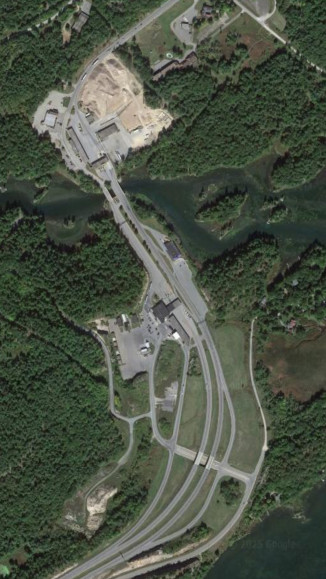
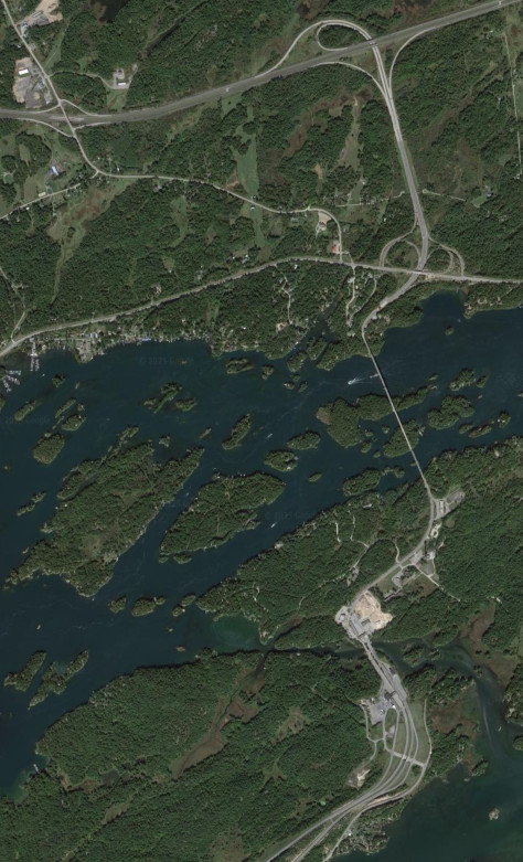
In the late 2010s, both the US and Canada expanded their border facilities in the Thousand Islands. This resulted in the exit to De Wolf Point becoming inaccessible to passenger cars traveling southbound (which has previously been possible, but not signed, by taking a right after clearing customs). The images above are from 2015 (top, Google) and 2022 (bottom, Google/Airbus).
Interstate 781
Interstate 781 was constructed to provide a connection between I-81 and Fort Drum, as well as US 11 heading northeast. It was opened in 2012. The images above are from 2006 (top, Google/USDA/FPAC/GEO) and 2016 (bottom, Google/USDA/FPAC/GEO).
NY 56
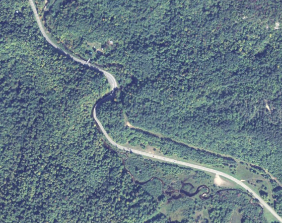
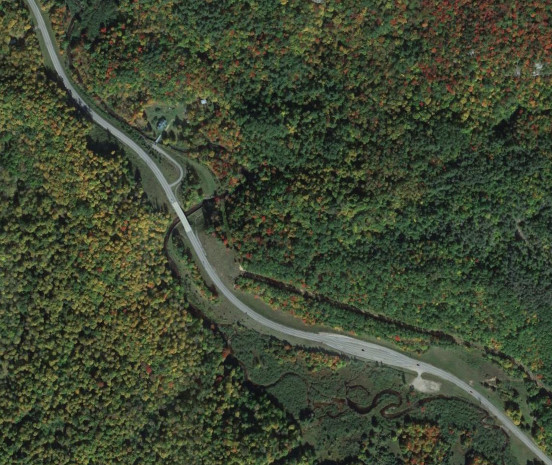
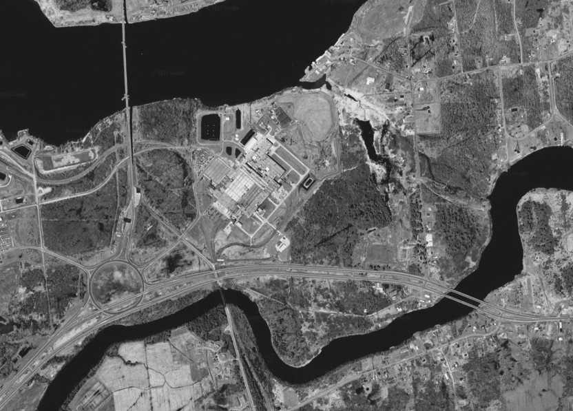
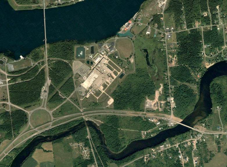
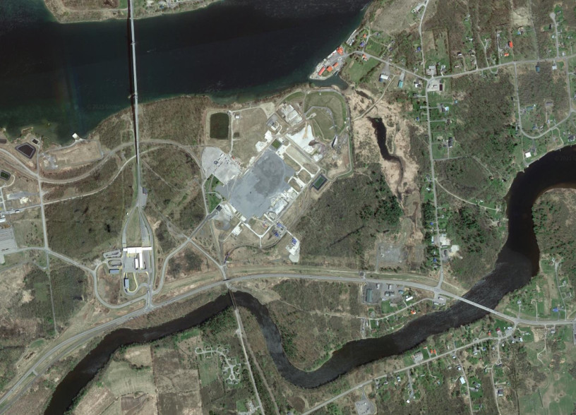
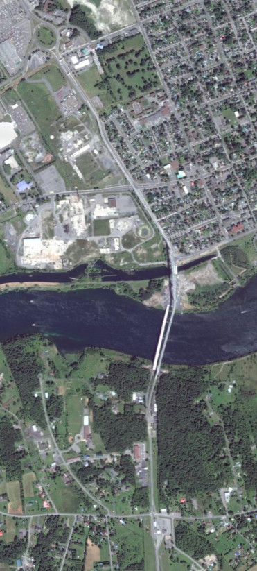
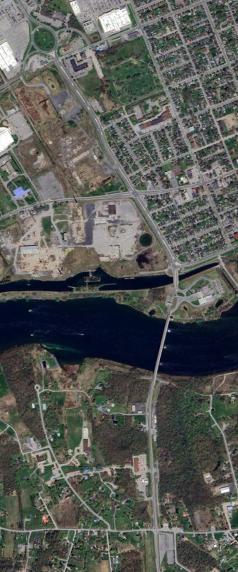
NY 56 had a S curve south of South Colton. For a few years, this was even a single lane controlled by traffic signals where a crossing over a creek was washed out. A new bridge was built in 2012, placing the road on a straighter alignment. The images above are from 2011 (top, Google/USDA/FPAC/GEO) and 2022 (bottom, Google/Airbus).
NY 189
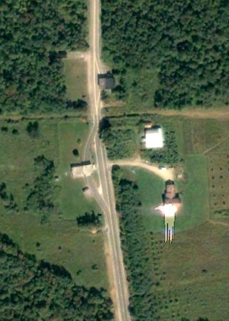
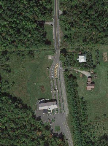
The border at Churubusco, NY and Dorea, QC is an interesting location. The Canadian border facilities were removed, making northbound travel from NY 189 onto QC 209 impossible, while the US border facilities were expanded. Provisions for northbound travel were constructed, should Canada ever decide to re-establish a border post at this location. The old road to the border was used to provide access to a private driveway. The images above are from 2007 (top, Google/U.S. Geological Survey) and 2013 (bottom, Google).
NY 812
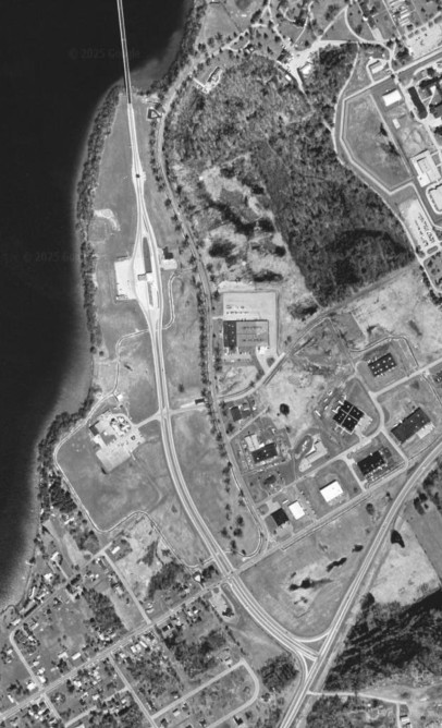
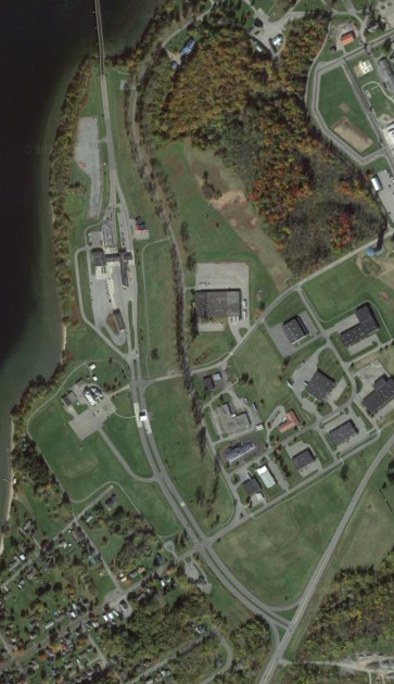
NY 812 ends crossing the border on the Ogdensburg-Prescott International Bridge. The area was reconfigured slightly when the US border facilities were expanded, causing the toll booths to move south. The images above are from 1997 (top, Google/U.S. Geological Survey) and 2013 (bottom, Google).
Seaway International Bridge
The American side of the Seaway International Bridge system has seen multiple changes over the years. The divided highway on NY 37 was truncated to west of the Akwesasne Nation when the bridge over the Raquette River was replaced, and then truncated again to west of the bridge when the US border facilities were expanded, using the area from the traffic circle. The images above are from 1997 (top, Google/U.S. Geological Survey), 2005 (middle, Google/U.S. Geological Survey), and 2015 (bottom, Google).
The Canadian side of the Seaway International Bridge has seen changes as well. The border facilities and toll booths were moved off Cornwall Island and onto the mainland due to a dispute between the Akwesasne Nation and the Canadian Border Services Agency. Temporary facilities were constructed at the traffic circle, cutting off Brookdale Avenue northbund for a few years, before more permanent facilities opened when the Canadian Span of the bridge was replaced with a smaller structure. The images above are from 2007 (top, Google/Maxar Technologies), 2013 (middle, Google/Maxar Technologies), and 2022 (bottom, Google/Airbus).