NY 47 was designated in the 1930s and originally routed from NY 31 in Gates to US 104 (now NY 404) in Irondequoit via Howard Road, Chili Avenue (NY 33A), Brooks Avenue (now NY 204 west of I-390), Genesee Park Boulevard, Genesee Street (NY 383), Elmwood Avenue, and Winton Road. Construction on what is now I-390/NY 390, I-590/NY 590, and Sea Breeze Drive began in the 1950s, and NY 47 was routed onto the new freeway and expressway segments as they were completed. By 1970, NY 47 began at US 104 in Greece and followed what is now NY 390 and I-390 to NY 383, which if followed for a short section before taking Elmwood Avenue to what is now I-590, NY 590, and Sea Breeze Drive to Culver Road (the freeway from Winton Road to Elmwood Avenue was not numbered at the time). In 1980, the NY 47 designation was removed, and replaced with I-390/NY 390 and I-590/NY 590. NY 590 itself was truncated to Titus Avenue in 2009 with the road north of there becoming Sea Breeze Drive. The gap in the freeway between NY 383 and Winton Road was filled in 1981.
The images below have been obtained from the U.S. Geological Survey (USGS) Eros Archive and Google Earth.
Contents
Interstate 390/NY 390
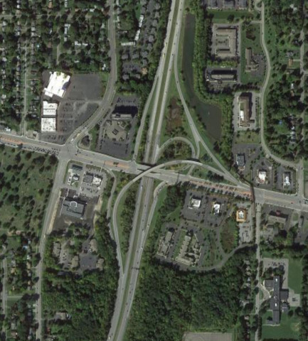
The interchange for NY 15 and NY 15A was modified around 2017 to improve access to those routes as well as the University of Rochester and Monroe Commnity College. The images above are from 2009 (top, Google/USDA/FPAC/GEO) and 2021 (bottom, Google).
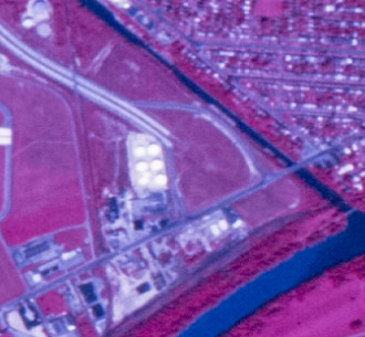
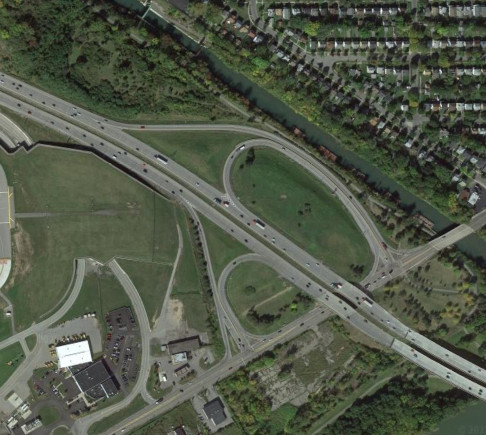
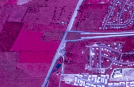
The I-390 freeway (then designated as NY 47) had a stub ending at NY 383 for a while. The final gap in the Outer Loop freeway was filled in 1981. The images above are from 1972 (top, USGS) and 2013 (bottom, Google).

The interchange with I-490 and NY 31 was modified from 2017 through 2021 to reduce weaving. The images above are from 2011 (top, Google) and 2022 (bottom, Google).
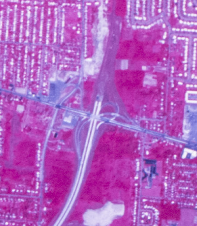
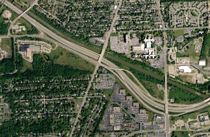
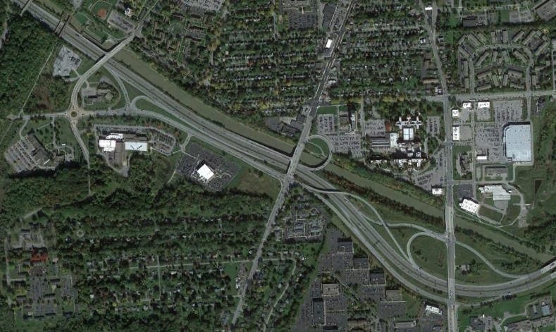
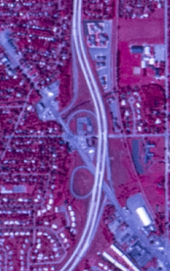
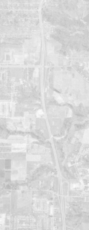
The original north end of NY 390 was at NY 104, inheriting the stub ending of NY 47. The freeway was extended north to the Lake Ontario State Parkway in 1983. The images above are from 1972 (top, USGS) and 2013 (bottom, Google).
Interstate 590/NY 590
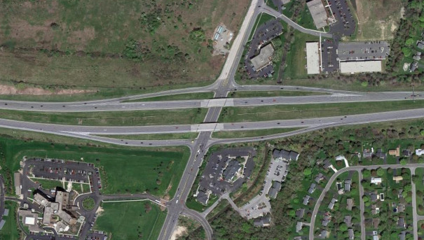
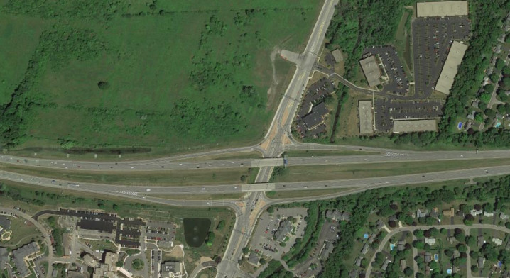
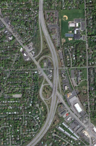
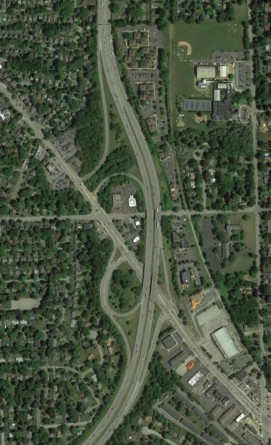
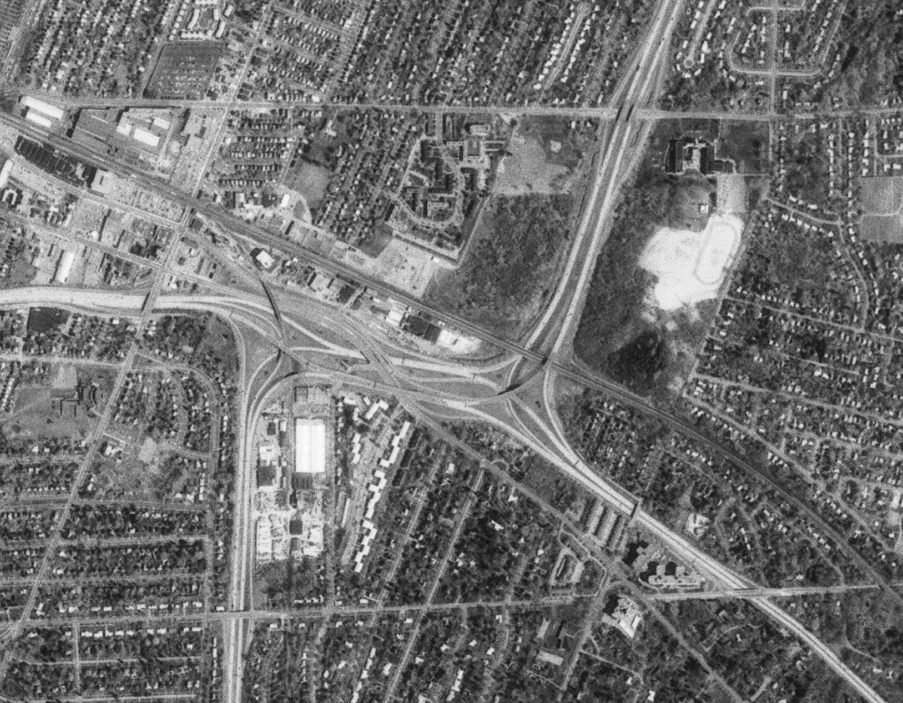
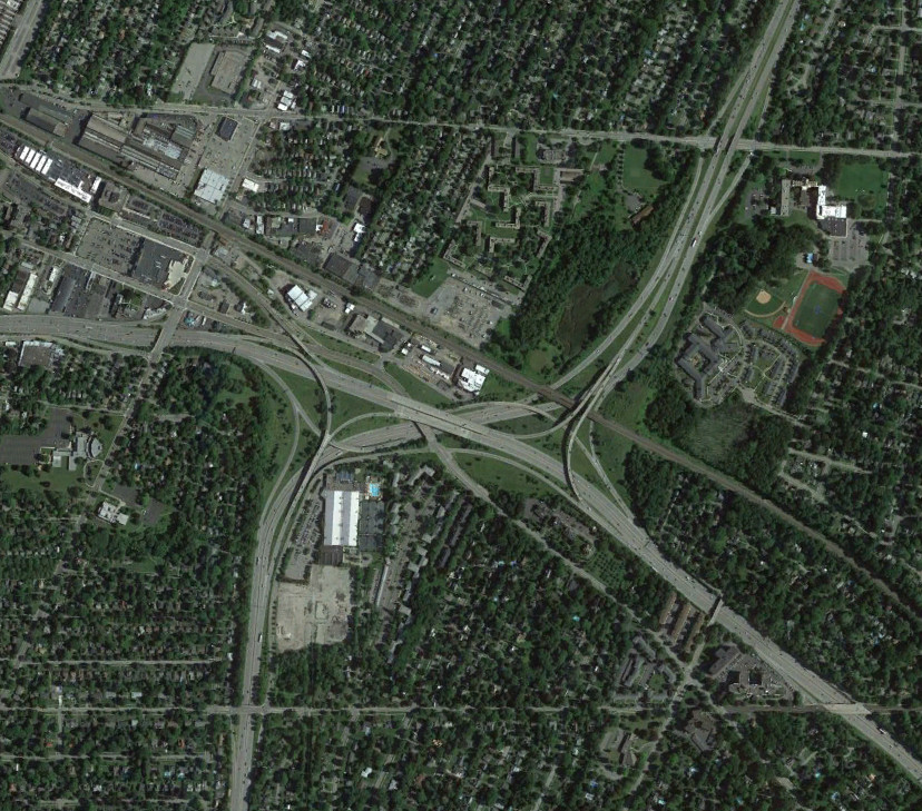
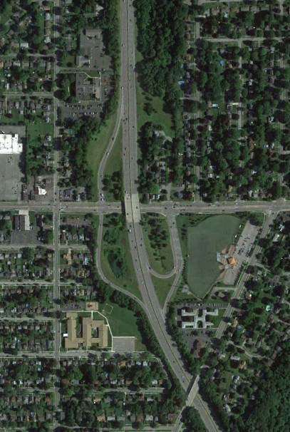
The freeway that became I-590 had a stub ending at Winton Road for many years. The gap in the Outer Loop freeway filled in 1981. In 2012, the interchange was converted to a diverging diamond interchange to better manage the turning traffic. The images above are from 1972 (top, USGS), 2011 (middle, Google), and 2018 (bottom, Google).
The interchange with NY 31 has seen modification as well, with the addition of the ramp from NY 31 east to I-590 south and later modification to allow left turns from NY 31 west onto that ramp. The images above are from 1972 (top, USGS), 2011 (middle, Google), and 2018 (bottom, Google).
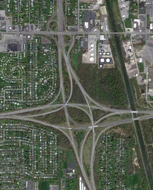
The interchange between I-590/NY 590 and I-490 is known as the "Can of Worms" and was reconstructed in the late 1980s to provide a thru alignment for 590 (eliminating the weave on I-490). The images above are from 1981 (top, USGS) and 2015 (bottom, Google).

The interchange with NY 404 (originally part of US 104) was built as a cloverleaf. Most of the loop ramps were eliminated in the 1980s. The images above are from 1981 (top, USGS) and 2015 (bottom, Google).


The NY 590 freeway opened before the NY 104 (originally US 104) freeway. It was first designated as a realignment of NY 18 before NY 47 was extended onto it in 1970. The modern designation of NY 590 was established in 1980 when the NY 47 designation was deleted. NY 590 was truncated to Titus Avenue and the route north of there modified into Sea Breeze Drive in 2009. The stub ramps on NY 104 were intended to provide the NY 104 west to NY 590 north and NY 590 south to NY 104 east movements and would have merged in near Titus Avenue. The images above show the route in 1960 (top, USGS), NY 590 at Norton Street in 2015 (middle, Google), and the interchange with NY 104 through Titus Avenue in 2015 (bottom, Google).

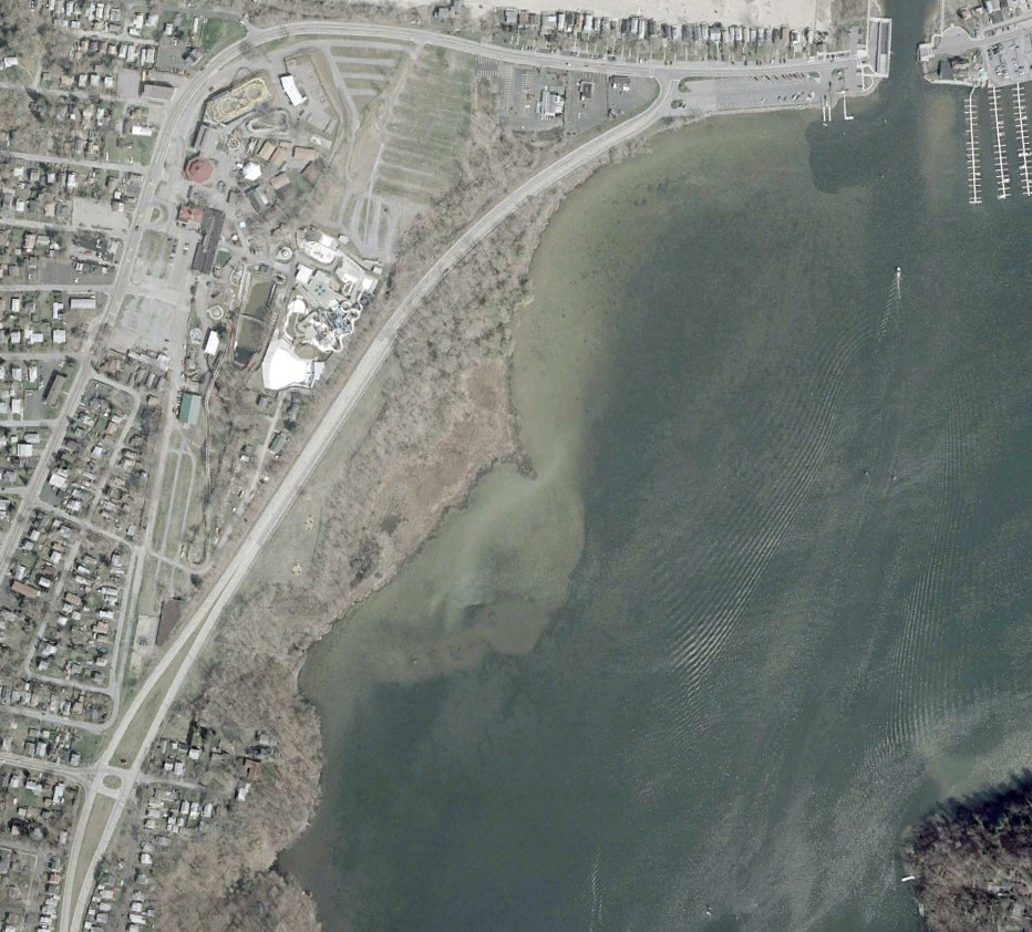
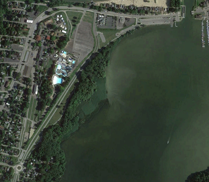
The NY 47 divided highway ended at Culver Road and led straight across the original Irondequoit Bay Outlet Bridge to Lake Road in Webster. The intersection was modified to hav the route (since redesignated NY 590) end at Culver Road in 1985 when the bridge closed to open up Irondequoit Bay to boating. The modern swing bridge opened in 1998. The intersection was moved west as part of the Sea Breeze Drive project around 2009, replacing the divided highway with a two-lane parkway. The images above are from 1972 (top, USGS), 2002 (middle, Google/New York GIS), and 2015 (bottom, Google).