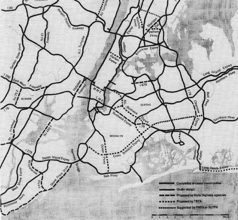
The New York City area had many planned expressways and parkways that did not come to fruition due to community opposition and the freeway revolt. As a result, the network is only a fraction of its intended size. Evidence of the larger network exists, such as I-78 ending just after crossing through the Holland Tunnel, NY/NJ 495, the stub endings of I-295 and the Korean War Veterans Parkway, stubs on NY 440, and even an unused interchange on I-278 in Staten Island that was later removed. The image above is from a 1964 report developed by the Tri-State Transportation Comission and published in the May 1964 edition of Regional Plan Association News, available on Steve Anderson's NYCRoads.com. The network is also roughly shown in a fictional map created by Vanshnookenraggen.
The system has seen notable evolution, including the removal of the West Side Highway. The images below have been obtained from the U.S. Geological Survey (USGS) Eros Archive and Google Earth.
Contents
The Bronx
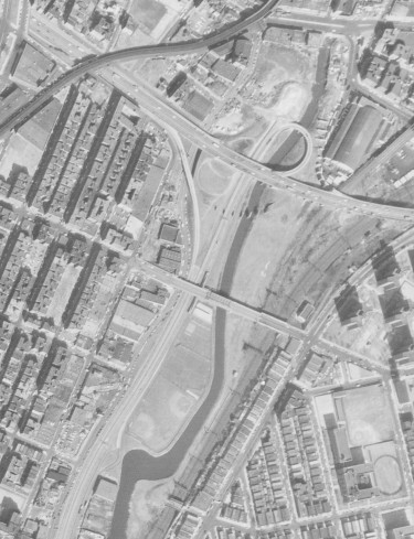
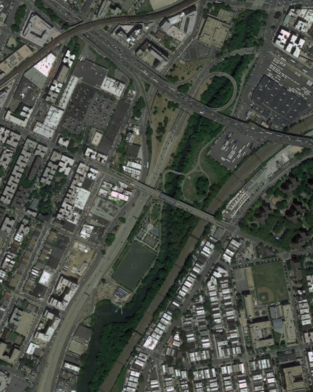
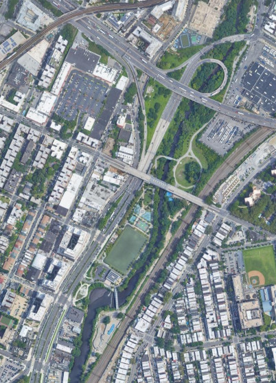
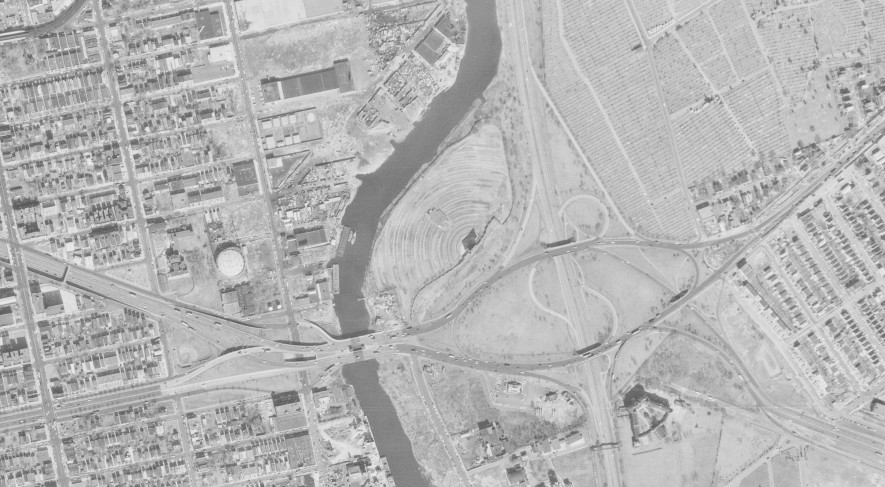
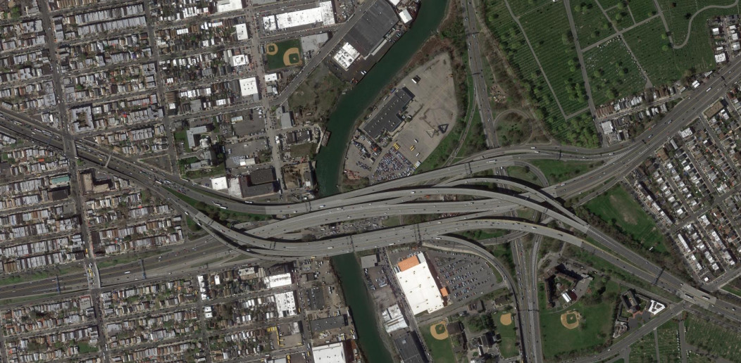
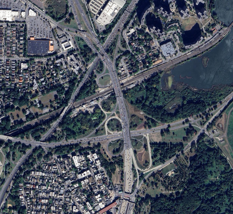
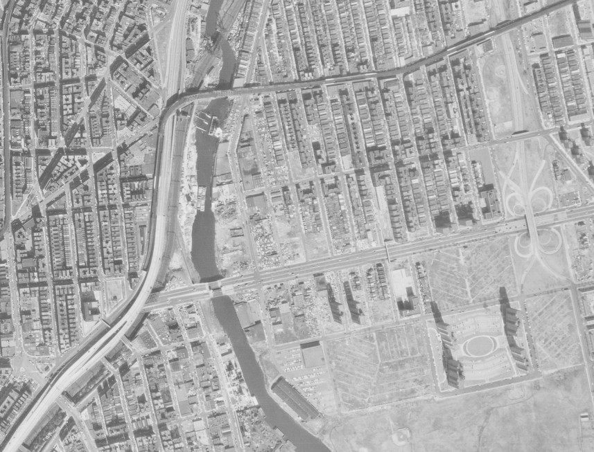
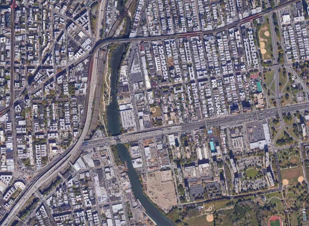
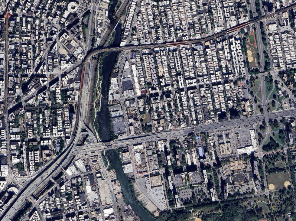
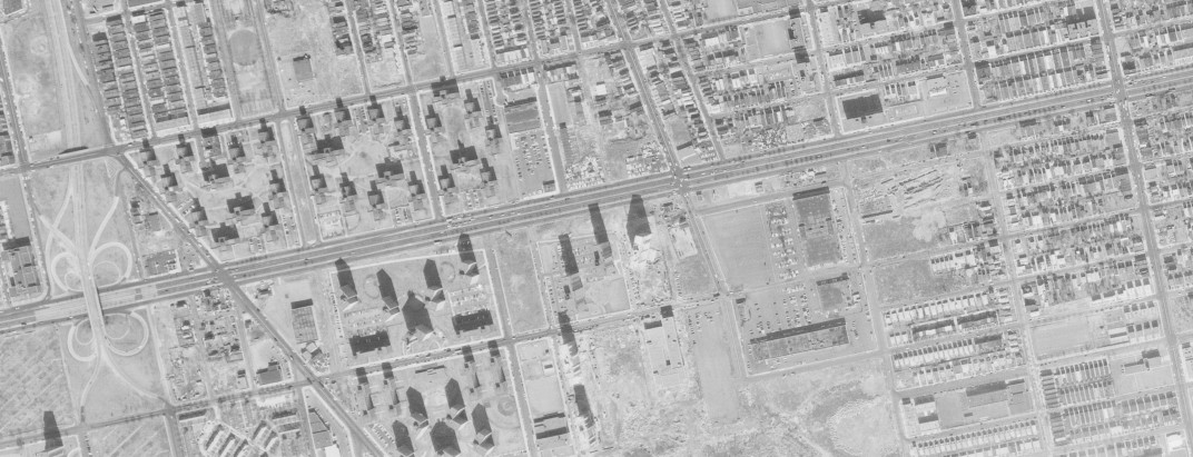
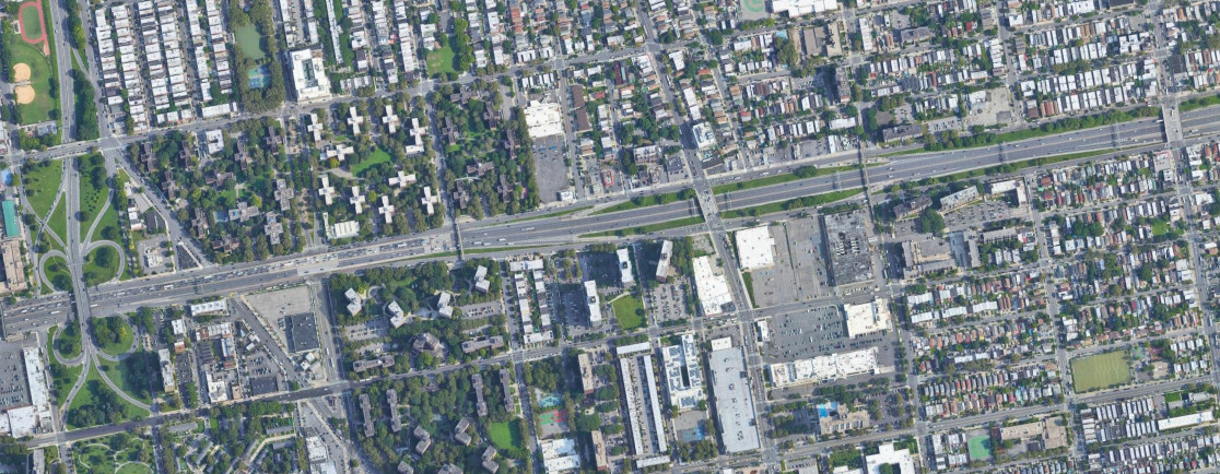
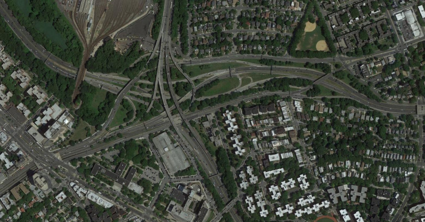
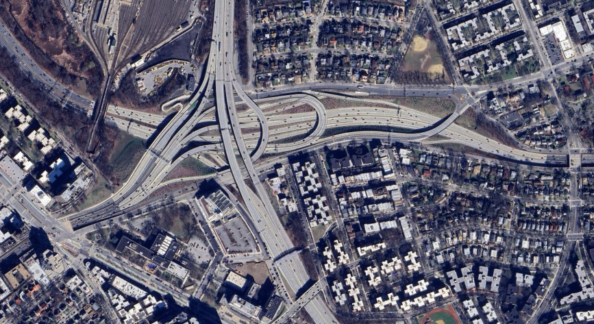
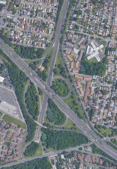
The interchange between the Cross-Bronx Expressway (I-95) and the Sheridan Expressway (I-895) used to have a stub where I-895 was to continue further north to meet up with the New England Thruway near Co-op City. In 2019, the Sheridan Expressway was converted into Sheridan Boulevard, with intersections allowing pedestrians to cross the road and get to the park along the Bronx River, and I-895 becoming NY 895. The images above are from 1966 (top, USGS), 2018 (middle, Google), and 2021 (bottom, Google).
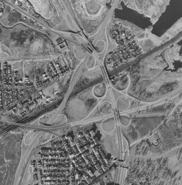
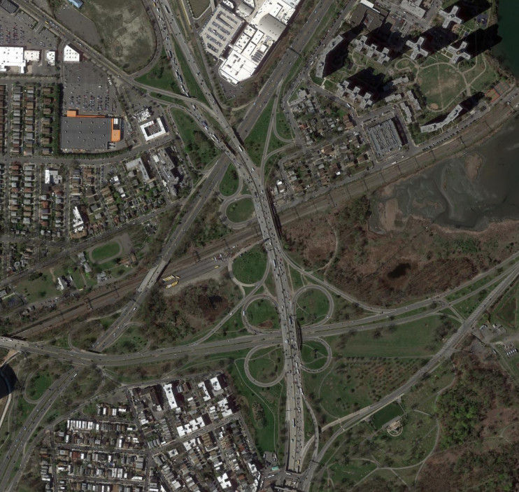
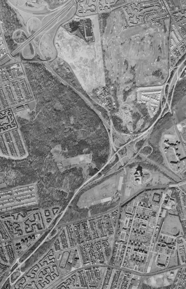
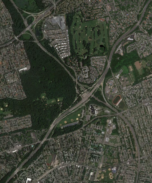
The Bruckner Interchange connects The Cross-Bronx Expressway (I-95 and I-295), the Bruckner Expressway (I-278 and I-95), the Whitestone Expressway (I-678), and the Hutchinson River Parkway. The interchange was extensively upgraded from its original form, with the northern ramps between the parkway and the service road (Bruckner Boulevard) being from the original interchange. The images above are from 1966 (top, USGS) and 2016 (bottom, Google).
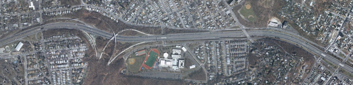
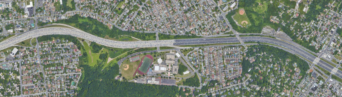
The Bruckner Expressway (I-95) becomes the New England Thruway at Pelham Parkway, with interchanges with the Hutchinson River Parkway and Gun Hill Road in the same area. The loop ramp from the Hutchinson River Parkway to I-95 north was eliminated, and more recently, the interchange with Pelham Parkway was reconfigured to reduce weaving along the congested expressway. The images above are from 1966 (top, USGS), 2016 (middle, Google), and 2025 (bottom, Google/Airbus).
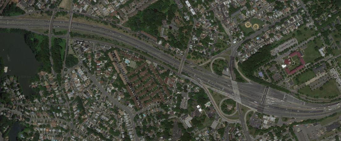
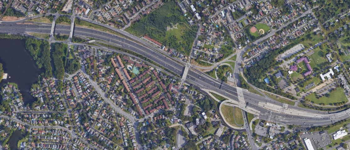
The major roads around Hunts Point have seen several changes, particularly with the interchange between the Bruckner (I-278) and the Sheridan (I-895/NY 895). Bruckner Boulevard east of the Sheridan Expressway became the Bruckner Expressway, while the Sheridan Expressway became Sheridan Boulvard in 2019, with I-895 becoming NY 895. Additional ramps were constructed to better connect Hunts Point market in 2022, with significant work to improve the Bruckner Expressway happening afterwards. The images above are from 1966 (top, USGS), 2017 (middle, Google), and 2025 (bottom, Google/Airbus).
Bruckner Boulevard was upgraded into the Bruckner Expressway (I-278) where it approaches the Bruckner Interchange. The ramps with the Bronx River Parkway, however, were left essentially unchanged. The images above are from 1966 (top, USGS) and 2021 (bottom, Google).
Brooklyn
The interchange where the Belt Parkway meets the Gowanus Expressway (I-278) and the Verrazzano-Narrows Bridge was modified to incorporate the lower level of the bridge. The images above are from 1966 (top, USGS) and 2017 (bottom, Google).
Manhattan
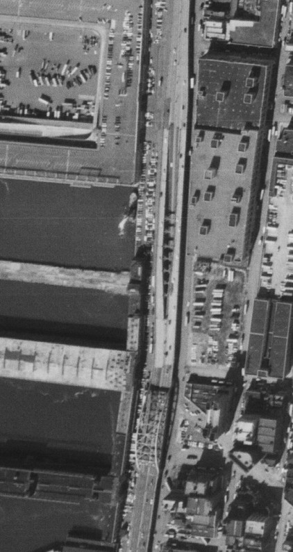
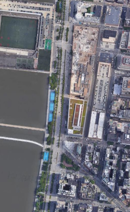
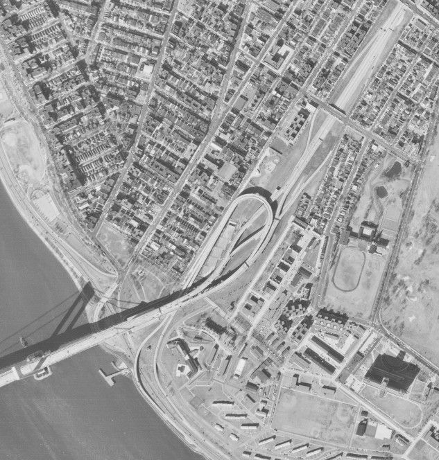
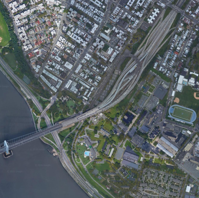
The West Side Highway was an elevated highway along the west side of Manhattan from the Brooklyn-Battery Tunnel to the Henry Hudson Parkway. The West Side Highway was narrow with sharp curves and ramps within the median, similar to the Pulaski Skyway in New Jersey. It was closed after a section collapsed in 1973 and demolished in sections, being fully replaced by West Street (NY 9A) in 1995. This interchange was at Canal Street near the Holland Tunnel (I-78); the images above are from 1966 (top, USGS) and 2019 (bottom, Google).
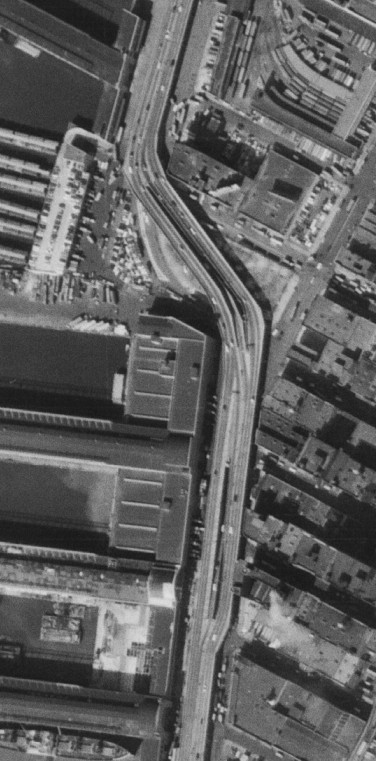
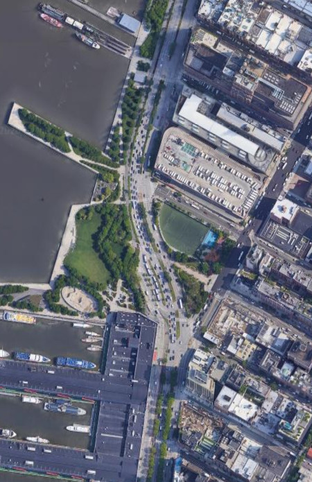
Near where West Street (NY 9A) intersects with 11th Avenue and 24th Street, the West Side Highway had an interchange with 19th Street (southbound) and 23rd Street (northbound). The images above are from 1966 (top, USGS) and 2019 (bottom, Google).
Queens
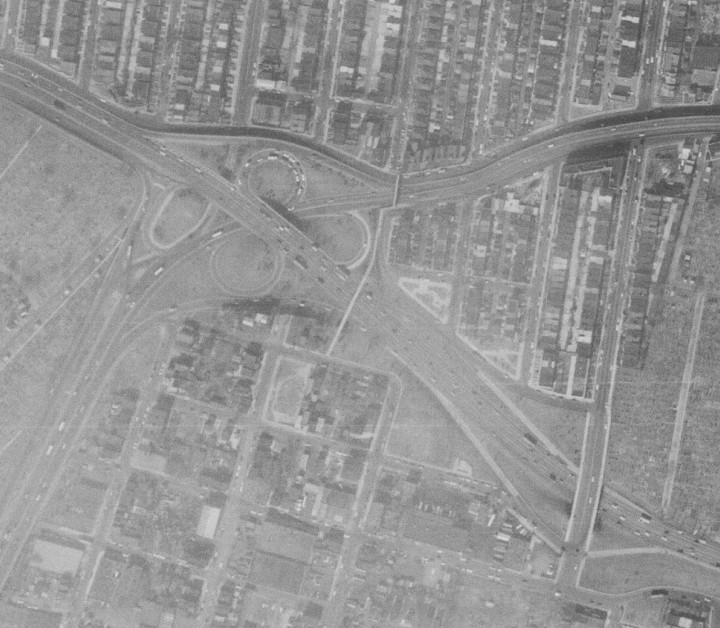
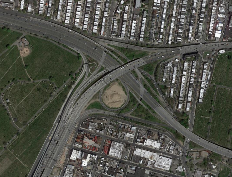
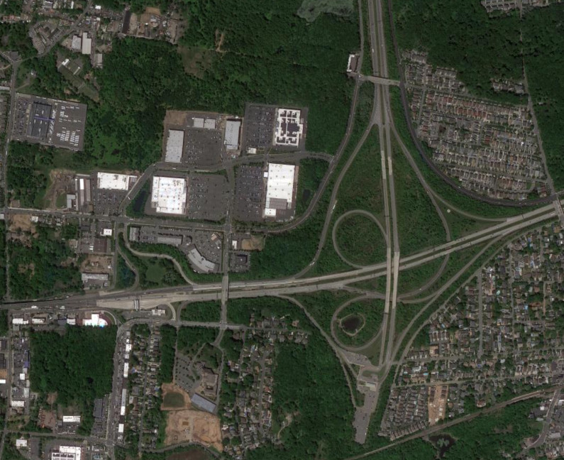
The interchange between the Long Island Expressway (I-495) and the Brooklyn-Queens Expressway (I-278) was originally a cloverleaf but has since been extensively modified. The images above are from 1966 (top, USGS) and 2022 (bottom, Google).
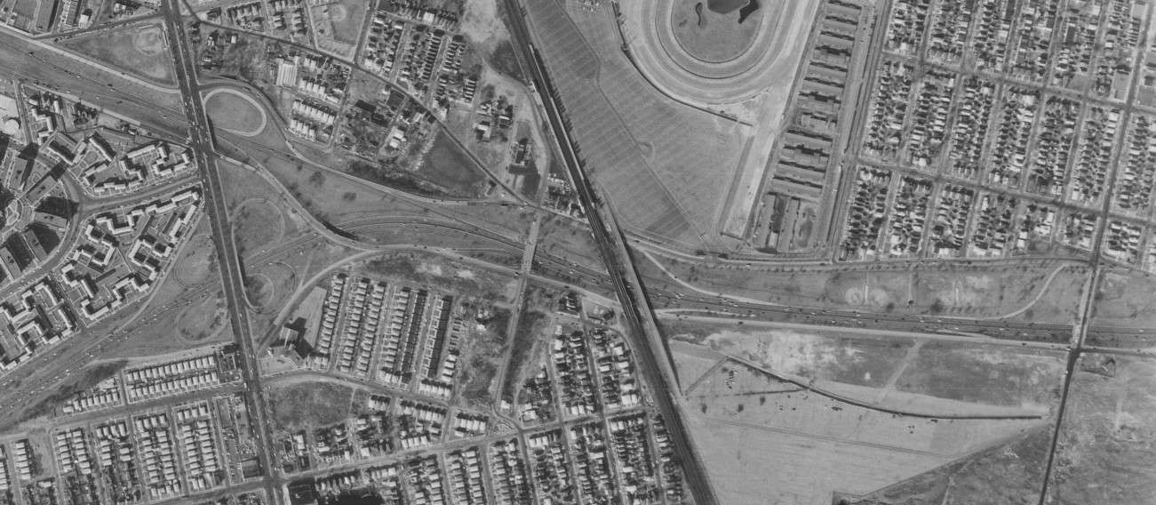
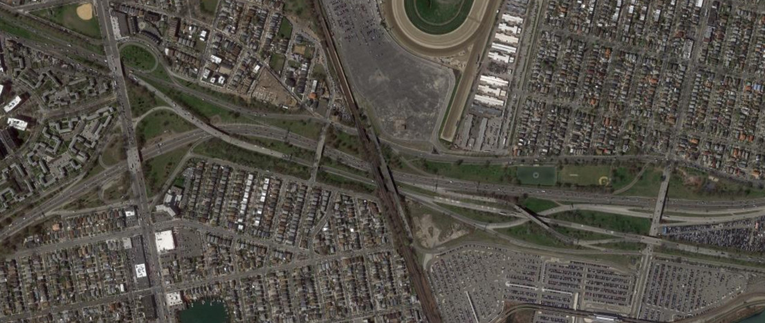
The Belt Parkway interchanges where it meets NY 27 were modified with the construction of the Nassau Expressway (NY 878). The images above are from 1966 (top, USGS) and 2016 (bottom, Google).
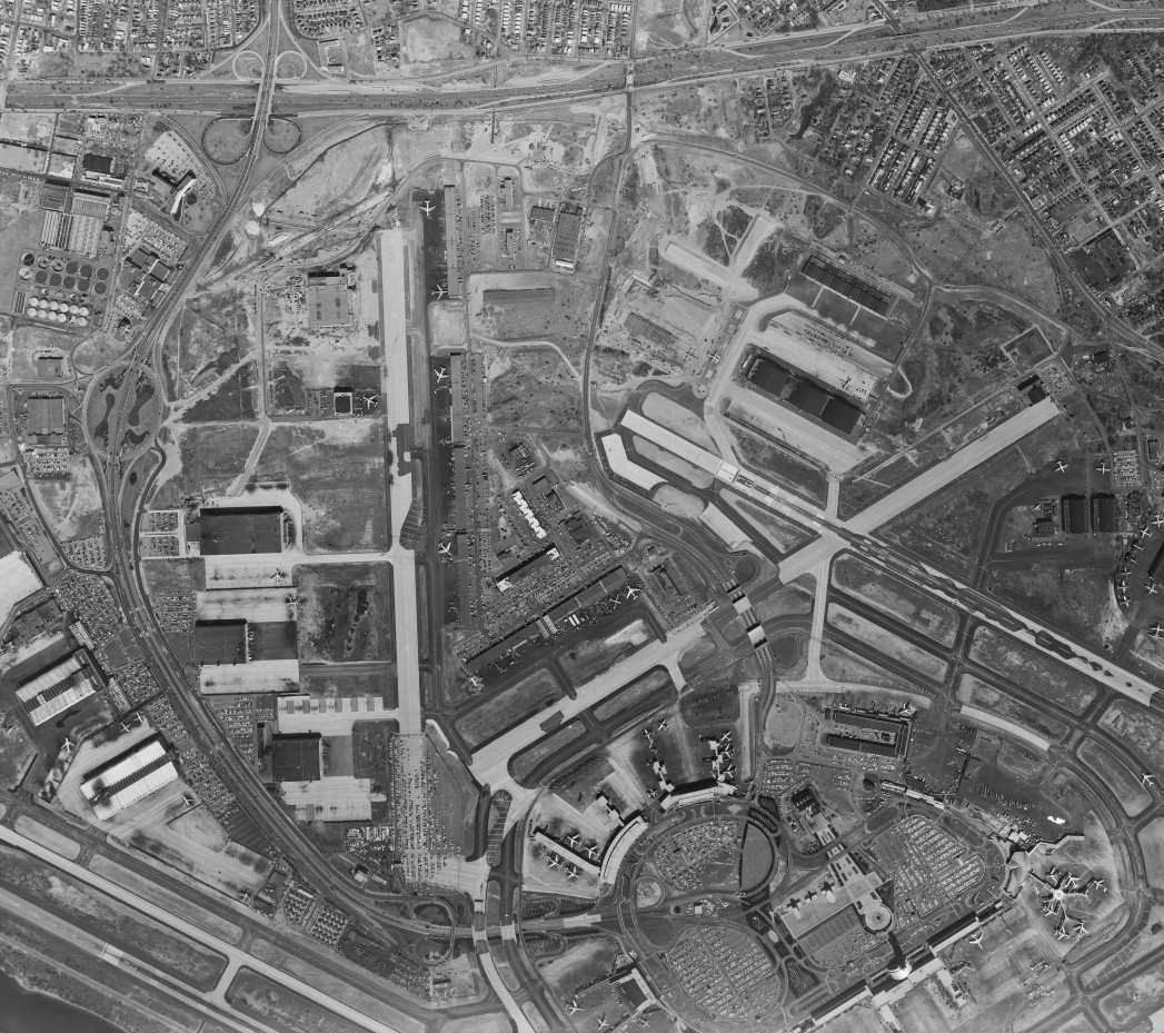
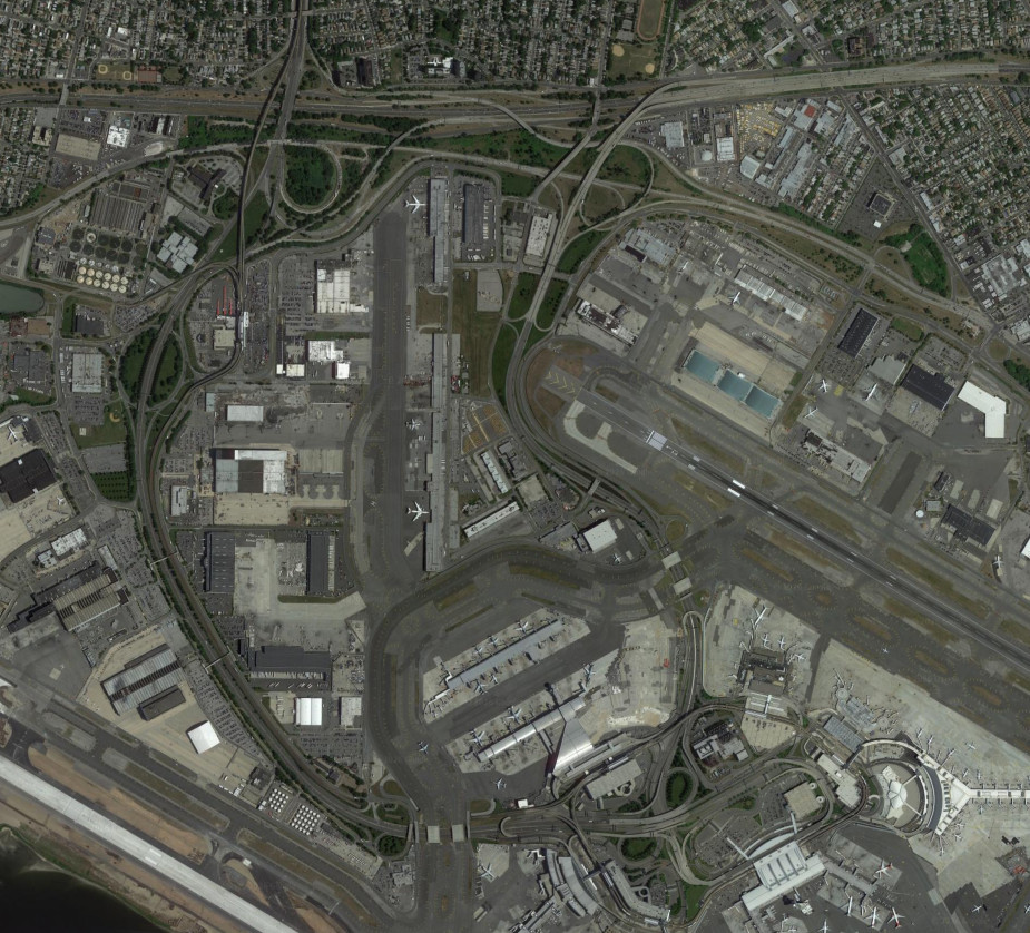
The roads in and around John F. Kennedy International Airpot (originally New York International Airport, commonly known as Idlewild Airport) have been modified extensively. The interchange on the Van Wyck Expressway (I-678) was modifided with terminal modifications as well as the construction of the JFK Expressway. The area around the Belt Parkway was also modified with the construction of the Nassau Expressway (NY 878/I-878). The images above are from 1966 (top, USGS) and 2010 (bottom, Google).
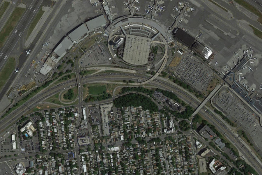
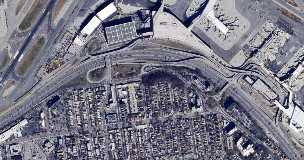
The interchange ramps on Grand Central Parkway at LaGuardia Airport saw extensive modification during the airport's modernization project. The images above are from 2010 (top, Google) and 2024 (bottom, Google/Airbus).
The Kew Gardens Interchange, connecting Grand Central Parkway, the Van Wyck Expressway (I-678), and the Jackie Robinson Parkway, was extensively upgraded between 2010 and 2022. The images above are from 2010 (top, Google) and 2024 (bottom, Google/Airbus).
Grand Central Parkway and the Cross Island Parkway have seen extensive modification near the area where they meet. The interchange between them has been reconfigured, as has the interchange between the Cross Island Parkway and the Long Island Expressway (I-495). The interchanges on Grand Central Parkway for Union Tunrpike and Little Neck Parkway were also modified, and an interchange with Springfield Boulevard was removed. The images above are from 1966 (top, USGS) and 2019 (bottom, Google).
Staten Island
The eastern end of the Staten Island Expressway (I-278) was modernized in the 2010s, resulting in some ramp reconfigurations and the removal of an unused interchagne that had been intended for the Korean War Veterans Parkway (formerly the Richmond Parkway). The images above are from 2008 (top, Google/U.S. Geological Survey) and 2021 (bottom, Google).
The eastern end of the Staten Island Expressway (I-278) was modernized in the 2010s, resulting in some ramp reconfigurations. The toll booths for the Verrazzano-Narrows Bridge were also removed when the bridge switched to all-electronic tolling. The images above are from 2010 (top, Google) and 2020 (bottom, Google).
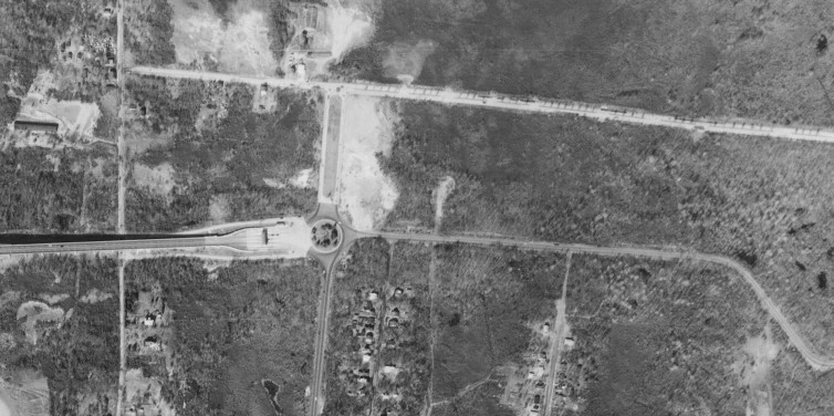
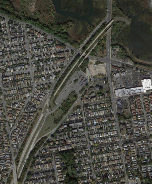
The eastern end of the Outerbridge Crossing was originally at a traffic circle with Page Avenue. It now connects directly to the Korean War Veterans Parkway (formerly the Richmond Parkway) and the West Shore Expressway (NY 440). The stub at the southern end of the West Shore Expressway, now used as a park and ride, was intended to connect to Shore Front Drive, which was never built. The images above are from 1966 (top, USGS) and 2018 (bottom, Google).
The interchange between the Staten Island Expressway (I-278) and the Dr. Martin Luther King Jr. Expressway (NY 440), formerly the Willowbrook Expressway, includes a stub that was intended for the Willowbrook Parkway, which was never built. The image above is from 2019 (Google).
The eastern end of the Korean War Veterans Parkway (formerly the Richmond Parkway) is a stub at Richmond Avenue and Arthur Kill Road where the parkway was intended to continue northeast to the Staten Island Expressway (I-278). The image above is from 2014 (Google).