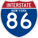
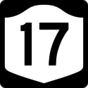
I-86 is an interstate in New York's Southern Tier, taking over the route of NY 17. The freeway starts at I-90 in Pennsylvania and ends at the Thruway in Harriman. NY 17, as of 2012, was the longest route in New York, with the freeway sections composed of the Southern Tier Expressway and the Quickway. Upgrades to the route are still ongoing. I-86 is currently signed on a couple of segments, and NY 17 signs are being phased out on the Southern Tier Expressway where I-86 is posted.
The original route of NY 17 was from Westfield to its present terminus at the New Jersey state border. It was realigned onto the Quickway and Southern Tier Expressway as those routes were completed. It is believed that NY 17 will be truncated to Harriman when the I-86 is completed. What is now I-86 in Pennsylvania was once PA 17, which was a duplicate route number.
| Actual Mile Posted Mile |
Eastbound | Westbound | Notes |
|---|---|---|---|
| 0.0 | New York Chautauqua County |
Pennsylvania Erie County |
|
| Speed Limit 65 | |||
| 1.0 | Exit 4 Findley Lake |
||
| 9.2 | Exit 6 Sherman |
||
| 15.4 | Exit 7 Panama Chautauqua Institution |
||
| 18.9 | Exit 8 Mayville Lakewood |
||
| 20.3 | Exit 9 Bemus Point |
||
| 20.6 | Left Exit 10 To Long Point State Park Midway State Park |
Exit 10 To Bemus Point Long Point State Park Midway State Park |
|
| 22.1 | Chautauqua Lake Rest Area Text Stop Truck Inspection |
||
| 26.3 | Exit 11 To Strunk Road Jamestown |
||
| 28.0 | Exit 12 Jamestown |
||
| 30.8 | Exit 13 Falconer |
||
| 36.1 | Exit 14 Kennedy Warren PA |
||
| Cattaraugus County | Chautauqua County | ||
| 38.4 | Parking Area Text Stop |
||
| 39.3 | Exit 15 School House Road |
||
| 40.6 | Parking Area Text Stop |
||
| 41.4 | Exit 16 West Main Street Randolph Gowanda |
||
| 47.9 | Exit 17 Steamburg Onoville |
||
| Seneca Nation o:notowa ke:ono' ohlyo:no' |
|||
| 50.7 | Exit 18 Allegany State Park Quaker Run Area |
||
| 54.5 | Exit 19 Allegany State Park Red House Area |
||
| 58.4 | Exit 20 Salamanca |
||
 |
|||
| 60.5 | Exit 21 Parkway Drive Salamanca |
||
| 67.6 | Exit 23 Limestone Bradford PA |
||
 |
|||
| Seneca Nation o:notowa ke:ono' ohlyo:no' |
|||
| 72.5 | Allegany River Rest Area Text Stop Truck Inspection |
||
| 74.1 | Exit 24 Allegany St. Bonaventure University |
||
| 77.3 | Exit 25 Buffalo Street Olean |
||
| 79.1 | Exit 26 Olean |
||
| 84.8 | Exit 27 Hinsdale |
||
| Allegany County | Cattaraugus County | ||
| 91.4 | Exit 28 Cuba |
||
| 98.9 | Exit 29 Friendship Bolivar |
||
| 101.4 | Friendship Rest Area Text Stop Truck Inspection |
||
| 104.6 | Exit 30 Belmont Wellsville |
||
| 108.6 | Exit 31 Angelica |
||
| 115.9 | Exit 32 West Almond |
||
| 123.6 | Exit 33 To Almond Andover |
||
| Steuben County | Allegany County | ||
| 125.0 | Scenic Overlook Text Stop |
||
| 128.3 | Exit 34A Hornell |
||
| 128.3 | Exit 34B Arkport |
||
| 138.0 | Exit 35 Howard |
||
| 145.0 | Exit 36 Rochester |
Left Exit 36 Rochester |
|
| 146.4 | Exit 37 Kanona Prattsburg |
||
| 146.9 | Kanona Rest Area Text Stop Truck Inspection |
||
| 149.5 | Exit 38 Bath Hammondsport |
||
| 152.7 | Exit 39 To Bath |
||
| 156.4 | Exit 40 Savona |
||
| 159.9 | Campbell Rest Area Text Stop Truck Inspection |
||
| 161.2 | Exit 41 Campbell |
||
| 165.2 | Exit 42 Coopers Plains |
||
| 166.8 | Parking Area Text Stop |
||
| 167.5 | Exit 43 Painted Post |
||
| 168.6 | Exits 44A-B Williamsport Gang Mills |
Exit 44A Williamsport Robert Dann Drive |
|
| 169.3 | Exit 45 Riverside Downtown Corning |
Exit 44B Painted Post Gang Mills |
|
| 169.5 | Exit 45 Riverside |
||
| 171.5 | Exit 46 Watkins Glen Corning |
||
| 174.2 | Exit 47 East Corning |
Exit 47 Gibson Corning |
|
| 176.6 | Exit 48 East Corning |
||
| 176.9 | Exit 48 East Corning |
||
| Chemung County | Stuben County | ||
| 178.9 178.1 |
Exit 49 Big Flats |
||
| 180.7 179.9 |
Exit 50 Kahler Road Elmira Corning Regional Airport |
||
| 182.4 181.6 |
Exit 51A Chambers Road |
||
| 183.1 182.3 |
Exit 51B Colonial Drive |
||
| 184.0 183.2 |
Exit 52A Commerce Center Road |
||
| 184.0 183.2 |
Exit 52B To Elmira Heights Watkins Glen |
Exit 52B Elmira Heights |
|
| 184.4 183.6 |
Exit 52A Watkins Glen |
||
| 185.3 184.5 |
Exit 53 Horseheads |
||
| 186.0 185.2 |
Exit 54 Ithaca |
Exit 54 Ithaca Horseheads |
|
| 190.2 189.4 |
Exit 56 Elmira Jerusalem Hill |
Church Street Former exit 56 (before current interchange was built) Exit 55 (not built) was intended to connect to NY 14 via an extension of Clemens Center Parkway |
|
| 190.6 189.8 |
Exit 56 Elmira Jerusalem Hill |
Water Street Former exit 57 (before current interchange was built) |
|
| Newtown Battlefield National Historic Landmark | |||
| 195.8 195.0 |
Exit 57 Lowman Wellsburg |
Formerly exit 58 | |
| Newtown Battlefield National Historic Landmark | |||
| 197.7 196.9 |
Exit 58 Lowman |
||
| 200.9 200.1 |
Exit 59 Chemung Wellsburg |
||
| 203.2 202.4 |
Exit 59A Wilawana |
Part of the ramps are in Pennsylvania |
|
| Tioga County | Chemung County | ||
| Pennsylvania Bradford County |
New York Tioga County |
||
| 205.2 204.4 |
Exit 60 Waverly Sayre |
Roadway in Pennsylvania maintained by NYSDOT | |
| New York Tioga County |
Pennsylvania Bradford County |
||
| 206.4 205.6 |
Exit 61 Waverly Sayre |
Part of the ramps are in Pennsylvania | |
| 212.9 212.1 |
Nichols Rest Area Text Stop Truck Inspection |
||
| 214.7 213.9 |
Exit 62 Nichols Tioga Downs |
||
| 219.3 218.5 |
Exit 63 Lounsberry |
||
| 222.3 221.5 |
Owego Rest Area Text Stop Truck Inspection |
||
| 223.3 222.5 |
Exit 64 Owego Ithaca |
||
| 224.1 223.3 |
Exit 64 Owego Ithaca |
||
| 225.6 224.8 |
Exit 65 Owego |
||
| 231.4 230.6 |
Exit 66 Apalachin |
Exit 66 Apalachin Campville |
|
| Broome County | Tioga County | ||
| 237.4 236.6 |
Exit 67S Vestal |
||
| 237.4 236.6 |
Exit 67N Endicott |
||
| 238.3 237.5 |
Exit 68 Vestal Road No re-entry Truck weight limit 5 tons |
||
| Speed Limit 55 | Speed Limit 65 | ||
| 240.1 239.3 |
Exit 69 Westover |
||
| 240.6 239.8 |
Exit 69 Endwell |
||
| 241.9 241.1 |
Exit 70S Johnson City |
||
| 241.9 241.1 |
Exit 70N Harry L. Drive Reynolds Road |
||
| 243.1 242.3 |
Exit 71 Airport Road Greater Binghamton Airport |
Exit 71S Johnson City |
|
| 243.1 242.3 |
Exit 71N Airport Road |
||
| 244.1 243.3 |
Exit 72 Prospect Street Mygatt Street |
||
| 244.5 243.7 |
Left Exit 72A Syracuse Albany |
||
| 245.1 244.3 |
Exit 72B Front Street Downtown Binghamton |
||
| 245.3 13.2 |
Syracuse Albany |
NY 17 exits at I-81 exit 13A. | |
| 245.9 12.6 |
Exit 12 Binghamton Port Dickinson |
Exit 73 | |
| 246.3 12.2 |
Exit 11 Broad Avenue |
Exit 74 | |
| Speed Limit 65 | Speed Limit 55 | ||
| 249.6 8.9 |
Exit 9 To Industrial Park |
Exit 74 |
|
| 250.2 8.3 |
Scranton |
||
| 250.5 249.7 |
Left Exit 75 Scranton Industrial Park |
||
| 251.5 250.7 |
Exit 76 Haskins Road Foley Road |
||
| 253.5 252.7 |
Exit 77 West Windsor |
||
| 256.7 255.9 |
Exit 78 Dunbar Road Occanum |
||
| 259.5 258.7 |
Exit 79 Windsor |
||
| 261.8 261.0 |
Exit 80 Damascus |
||
| 264.6 263.8 |
Exit 81 Earl Bosket Road |
||
| 265.6 264.8 |
Parking Area | ||
| 270.2 269.4 |
Exit 82 McClure Sanford |
||
| 272.5 271.7 |
Exit 83 Oquaga Lake |
||
| 273.2 272.4 |
Exit 83 Deposit Oquaga Lake |
||
| Delaware County | Broome County | ||
| 274.9 274.1 |
Exit 84 Deposit Walton |
||
| 276.5 275.7 |
Parking Area | ||
| Speed Limit 55 | Speed Limit 65 | ||
| Intersections Next 5 miles |
|||
| 278.4 277.6 |
Hungry Hollow Road | At-grade intersection | |
| 278.8 278.0 |
Exit 85 Hale Eddy |
At-grade intersection Exit number not posted. |
|
| 279.4 278.6 |
Lower Hale Eddy Road | At-grade intersection | |
| 280.3 279.5 |
Exit 86 Silver Lake Road Roods Creek Road |
At-grade intersection Exit number not posted. |
|
| Intersections Next 5 miles |
|||
| 285.9 285.1 |
Exit 87 Hancock Cadosia |
Exit 87 Hancock |
|
| 288.1 287.3 |
Exit 87A Cadosia Hancock |
||
| 293.1 292.3 |
Exit 89 Fishs Eddy |
||
| 293.5 292.7 |
Exit 89 Fishs Eddy |
||
| 295.6 294.8 |
East Branch Rest Area Text Stop Truck Inspection |
||
| 297.4 296.6 |
Exit 90 East Branch Downsville |
||
| 297.6 296.8 |
Exit 90 East Branch Downsville |
||
| Catskill Park | NY 17 skirts the boundary of the park | ||
| 303.9 303.1 |
Exit 92 Horton Cooks Falls |
||
| 304.3 303.5 |
Exit 92 Horton |
||
| 305.8 305.0 |
Exit 93 Cooks Falls |
||
| Sullivan County | Delaware County | ||
| 311.2 310.4 |
Exit 94 Roscoe Lew Beach |
||
| 311.4 310.6 |
Exit 94 Roscoe Walton |
||
| Speed Limit 65 | Speed Limit 55 | ||
| 314.0 313.2 |
Roscoe Rest Area Text Stop Truck Inspection |
||
| 317.1 316.3 |
Exit 96 Livingston Manor |
||
| Catskill Park | NY 17 skirts the boundary of the park | ||
| 319.3 318.5 |
Exit 97 Morsston |
||
| 319.7 318.9 |
Exit 97 Morsston |
||
| 322.2 321.4 |
Exit 98 Parksville |
Parksville bypass opened in 2011; prior to then, "exit 98" was a traffic light |
|
| 325.4 324.6 |
Exit 99 To Liberty |
Exit 99 Liberty North Main Street |
|
| 326.4 325.6 |
Exit 100A Liberty |
||
| 327.0 326.2 |
Exit 100 Liberty |
||
| 327.4 326.6 |
Exit 100 Liberty |
||
| 328.3 327.5 |
Exit 101 Ferndale Swan Lake |
||
| 332.4 331.6 |
Exit 102 Harris Bushville |
||
| 333.0 332.2 |
Exit 102 Harris Bushville |
||
| 334.3 333.5 |
Exit 103 Rapp Road |
||
| Speed Limit 55 | Speed Limit 65 | ||
| 336.6 335.8 |
Exit 104 Raceway Monticello |
||
| 338.0 337.2 |
Exit 105 Monticello Kiamesha |
||
| Speed Limit 65 | Speed Limit 55 | ||
| 339.9 339.1 |
Exit 106 East Broadway |
||
| 341.1 340.3 |
Exit 107 Bridgeville South Fallsburg |
||
| 342.0 341.2 |
Exit 108 Bridgeville |
||
| 342.9 342.1 |
Exit 109 Rock Hill Woodridge |
||
| 344.0 343.2 |
Exit 110 Lake Louise Marie Wanaksink Lake |
||
| 344.3 343.5 |
Exit 110 Lake Louise Marie Wanaksink Lake |
||
| 345.2 344.4 |
Exit 111 Wolf Lake |
||
| Speed Limit 55 | Speed LImit 65 | ||
| 348.1 347.3 |
Exit 112 Masten Lake Yankee Lake |
||
| 350.5 349.7 |
Exit 113 Wurtsboro Ellenville |
||
| 352.8 352.0 |
Exit 114 Wurtsboro Highview |
||
| 355.0 354.2 |
Exit 115 Burlingham Road |
||
| Speed Limit 65 | |||
| Orange County | Sullivan County | ||
| 355.7 | Exit 116 Bloomingburg Montgomery |
||
| Speed Limit 55 | |||
| 358.1 | Exit 118 Fair Oaks |
||
| 359.9 | Exit 119 Pine Bush |
||
| 362.7 | Exit 120W Middletown |
||
| 362.7 | Exit 120E Montgomery |
Exit 120 Middletown Montgomery |
|
| 363.6 | Exit 121W Scranton |
||
| 363.6 | Exit 121E Newburgh |
||
| 364.2 | Exit 122 Middletown Crystal Run |
||
| 366.9 | Exit 122A Fletcher Street Goshen |
||
 |
|||
| 367.6 | Exit 123 Middletown Port Jervis |
||
| 368.0 | Exit 124 Florida Goshen |
||
 |
|||
| 368.3 | Exit 124 Florida Goshen |
||
|
|||
| 369.6 | Exit 125 Harriman Drive South Street |
Exit 125 was moved to Harriman Drive from South Street in 2020 | |
| 371.9 | Exit 126 Chester Florida |
||
| 373.6 | Exit 127 Greycourt Road Sugar Loaf Warwick |
||
| 375.4 | Exit 128 Oxford Depot |
||
| 376.8 | Exit 129 Museum Village Road |
||
| 377.3 | Exit 130 Monroe Washingtonville |
||
| 380.4 | Exit 130A Bear Mountain |
||
| 380.9 | Exit 131 Newburgh Suffern Last exit before toll |
Exit 131 Woodbury Harriman |
Hudson Valley/Catskills Welcome Center The remainder of the Quickway to the Thruway is reference route 984C. |
Albany New York City |
|||
| 381.4 | Left Albany |
||
| 381.4 | New York City |
To |
|
| Speed Limit 65 | |||
| Orange County | |||
Spur Route
The Sourthern Tier Expressway has a short spur (reference route 954J) in Bemus Point connecting from exit 10 to NY 430. It appears to be a remnanent of a longer spur that might have been planned to serve Mayville and Westfield. Some speculate that it may have been planned to be part of a former routing of the Southern Tier Expressway, and the reference route has reference markers marked 17.
| Mile | Eastbound | Westbound | Notes |
|---|---|---|---|
| Chautauqua County | |||
| Speed Limit 55 | |||
| 0.0 | To Jamestown Erie, PA |
Long Point State Park Midway State Park |
|
| 0.0 | Bemus Point Ellery Center |
||
| 1.2 | Erie, PA |
||
| 1.2 | Jamestown |
To |
|
| Speed Limit 55 | |||
| Chautauqua County | |||